
HOOD Mt Hood Meadows, OR CREST BB SMO - Earthquake Result Viewer
| ||||||||||||||||||
| ||||||||||||||||||
| ||||||||||||||||||
|
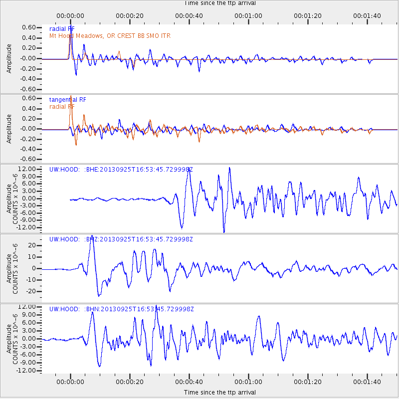
Signal To Noise
| Channel | StoN | STA | LTA |
| UW:HOOD: :BHZ:20130925T16:53:45.729998Z | 8.010271 | 2.2848938E-6 | 2.852455E-7 |
| UW:HOOD: :BHN:20130925T16:53:45.729998Z | 1.9684186 | 5.575479E-7 | 2.832466E-7 |
| UW:HOOD: :BHE:20130925T16:53:45.729998Z | 3.2705681 | 9.829577E-7 | 3.0054645E-7 |
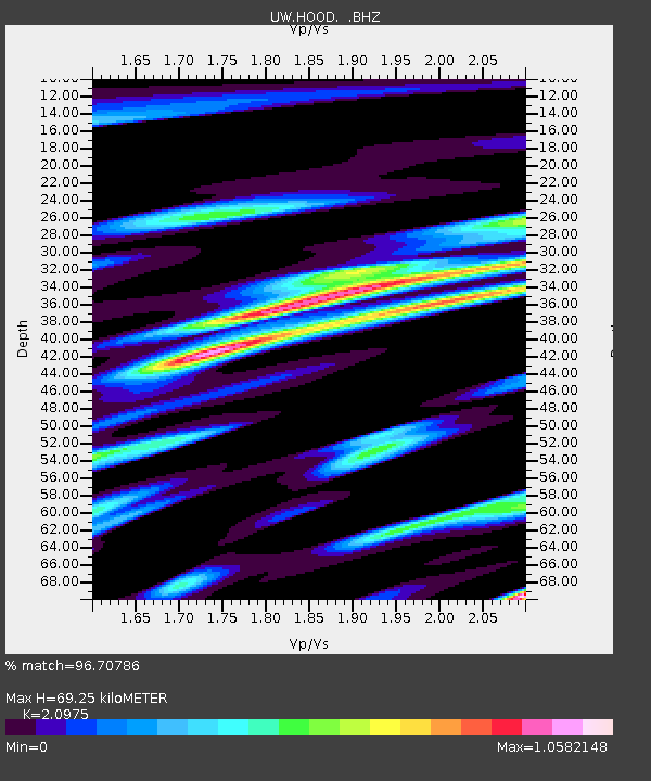
| Arrivals | |
| Ps | 12 SECOND |
| PpPs | 32 SECOND |
| PsPs/PpSs | 43 SECOND |

