
LON Longmire (broad-band and DWWSSN) - Earthquake Result Viewer
| ||||||||||||||||||
| ||||||||||||||||||
| ||||||||||||||||||
|
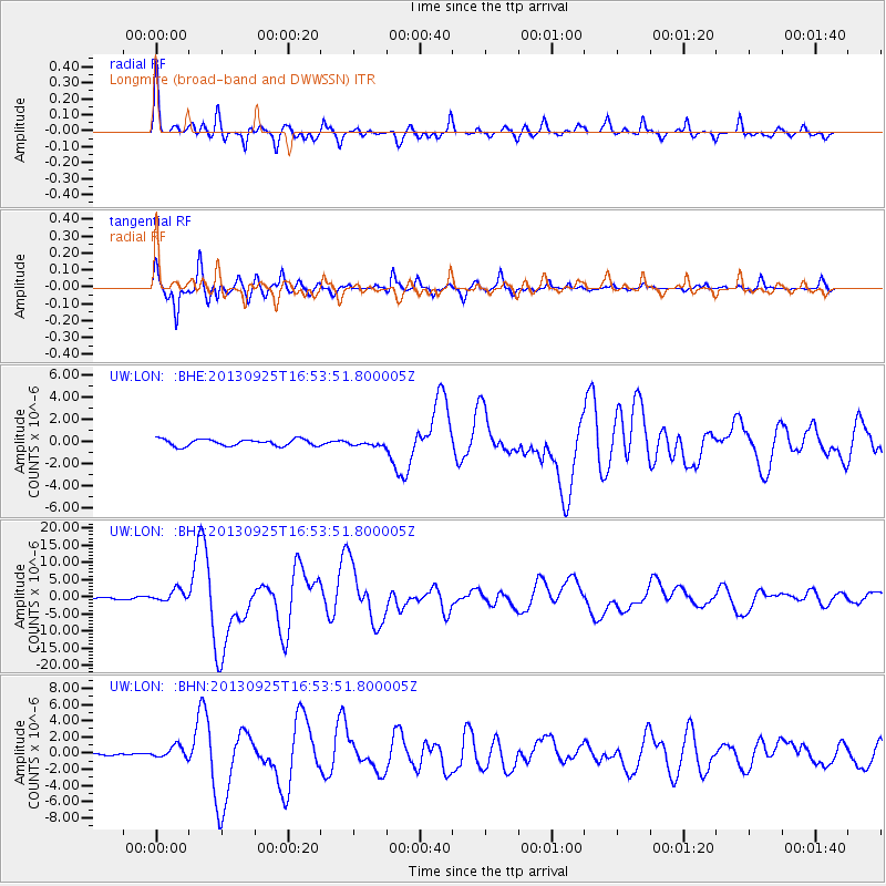
Signal To Noise
| Channel | StoN | STA | LTA |
| UW:LON: :BHZ:20130925T16:53:51.800005Z | 8.723321 | 1.7405692E-6 | 1.9953058E-7 |
| UW:LON: :BHN:20130925T16:53:51.800005Z | 6.334547 | 7.2092485E-7 | 1.13808426E-7 |
| UW:LON: :BHE:20130925T16:53:51.800005Z | 0.7124681 | 2.1744496E-7 | 3.0519956E-7 |
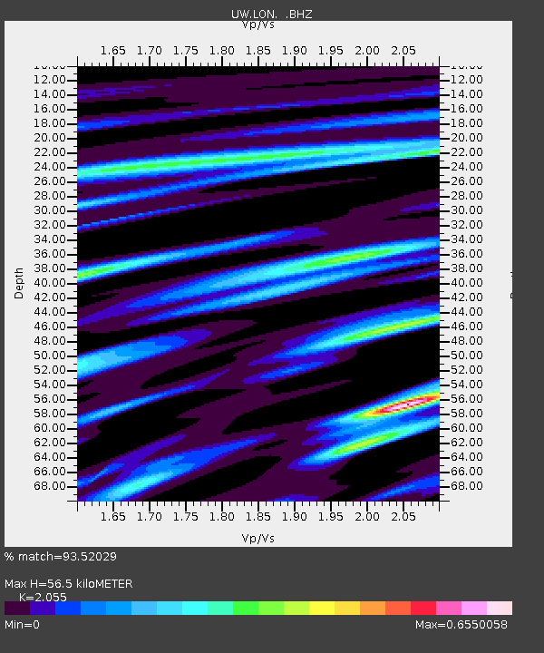
| Arrivals | |
| Ps | 9.3 SECOND |
| PpPs | 25 SECOND |
| PsPs/PpSs | 35 SECOND |

