You are here: Home > Network List > PF - Volcanologic Network of Piton de Fournaise-OVPF Stations List
> Station FRE Station Sismologique des Fonds de la Riviere de l'Est > Earthquake Result Viewer
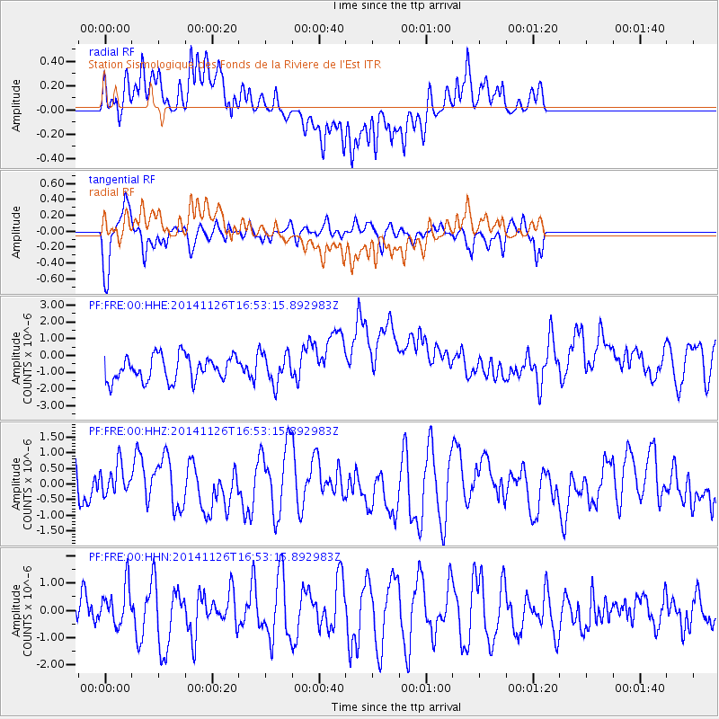
FRE Station Sismologique des Fonds de la Riviere de l'Est - Earthquake Result Viewer
*The percent match for this event was below the threshold and hence no stack was calculated.
| Earthquake location: |
New Ireland Region, P.N.G. |
| Earthquake latitude/longitude: |
-4.7/153.0 |
| Earthquake time(UTC): |
2014/11/26 (330) 16:40:30 GMT |
| Earthquake Depth: |
55 km |
| Earthquake Magnitude: |
5.0 mb, 5.0 mb |
| Earthquake Catalog/Contributor: |
ISC/ISC |
|
| Network: |
PF Volcanologic Network of Piton de Fournaise-OVPF |
| Station: |
FRE Station Sismologique des Fonds de la Riviere de l'Est |
| Lat/Lon: |
21.20 S/55.70 E |
| Elevation: |
1775 m |
|
| Distance: |
95.1 deg |
| Az: |
248.313 deg |
| Baz: |
97.046 deg |
| Ray Param: |
$rayparam |
*The percent match for this event was below the threshold and hence was not used in the summary stack. |
|
| Radial Match: |
62.84737 % |
| Radial Bump: |
400 |
| Transverse Match: |
61.4015 % |
| Transverse Bump: |
400 |
| SOD ConfigId: |
3390531 |
| Insert Time: |
2019-04-15 05:14:41.815 +0000 |
| GWidth: |
2.5 |
| Max Bumps: |
400 |
| Tol: |
0.001 |
|
Signal To Noise
| Channel | StoN | STA | LTA |
| PF:FRE:00:HHZ:20141126T16:53:15.892983Z | 0.9224483 | 4.9059213E-7 | 5.3183703E-7 |
| PF:FRE:00:HHN:20141126T16:53:15.892983Z | 0.7192511 | 7.491836E-7 | 1.0416162E-6 |
| PF:FRE:00:HHE:20141126T16:53:15.892983Z | 1.2121695 | 8.9140536E-7 | 7.353801E-7 |
| Arrivals |
| Ps | |
| PpPs | |
| PsPs/PpSs | |


