You are here: Home > Network List > AK - Alaska Regional Network Stations List
> Station MDM Murphy Dome > Earthquake Result Viewer
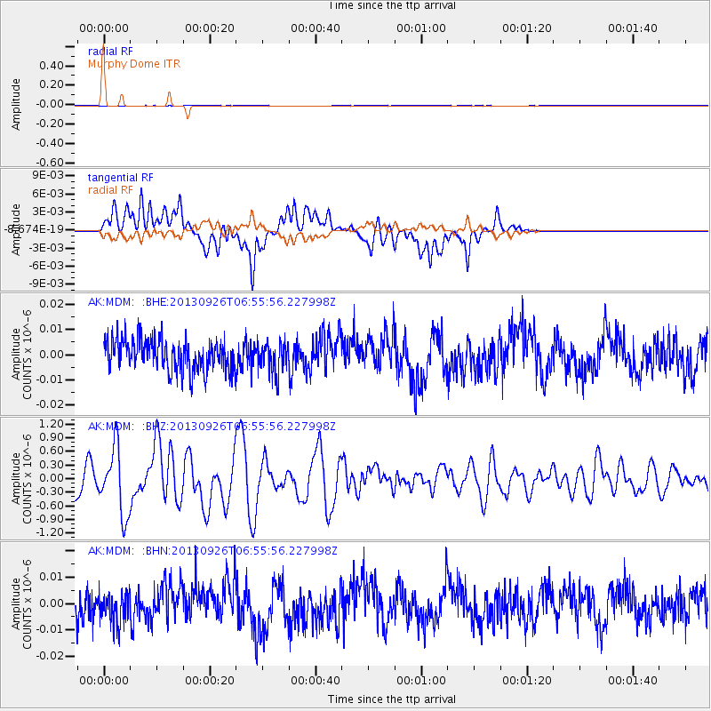
MDM Murphy Dome - Earthquake Result Viewer
*The percent match for this event was below the threshold and hence no stack was calculated.
| Earthquake location: |
Near Coast Of Chiapas, Mexico |
| Earthquake latitude/longitude: |
14.4/-93.4 |
| Earthquake time(UTC): |
2013/09/26 (269) 06:46:03 GMT |
| Earthquake Depth: |
8.8 km |
| Earthquake Magnitude: |
5.5 MWB, 5.7 MWC |
| Earthquake Catalog/Contributor: |
NEIC PDE/NEIC COMCAT |
|
| Network: |
AK Alaska Regional Network |
| Station: |
MDM Murphy Dome |
| Lat/Lon: |
64.96 N/148.23 W |
| Elevation: |
634 m |
|
| Distance: |
62.5 deg |
| Az: |
336.905 deg |
| Baz: |
116.757 deg |
| Ray Param: |
$rayparam |
*The percent match for this event was below the threshold and hence was not used in the summary stack. |
|
| Radial Match: |
58.56515 % |
| Radial Bump: |
400 |
| Transverse Match: |
56.37746 % |
| Transverse Bump: |
400 |
| SOD ConfigId: |
626651 |
| Insert Time: |
2014-04-18 21:00:50.527 +0000 |
| GWidth: |
2.5 |
| Max Bumps: |
400 |
| Tol: |
0.001 |
|
Signal To Noise
| Channel | StoN | STA | LTA |
| AK:MDM: :BHZ:20130926T06:55:56.227998Z | 2.4918694 | 7.3774845E-7 | 2.9606224E-7 |
| AK:MDM: :BHN:20130926T06:55:56.227998Z | 0.98938686 | 6.190801E-9 | 6.25721E-9 |
| AK:MDM: :BHE:20130926T06:55:56.227998Z | 0.94948226 | 5.871973E-9 | 6.1843948E-9 |
| Arrivals |
| Ps | |
| PpPs | |
| PsPs/PpSs | |


