You are here: Home > Network List > G - GEOSCOPE Stations List
> Station TAM Tamanrasset, Algeria > Earthquake Result Viewer
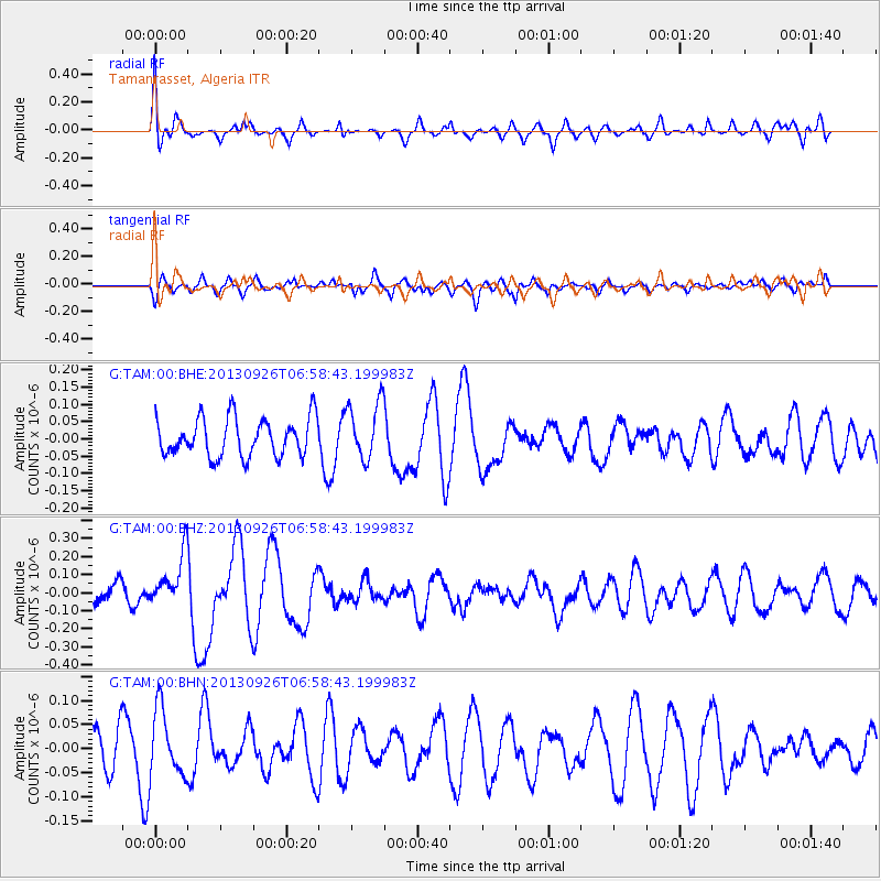
TAM Tamanrasset, Algeria - Earthquake Result Viewer
*The percent match for this event was below the threshold and hence no stack was calculated.
| Earthquake location: |
Near Coast Of Chiapas, Mexico |
| Earthquake latitude/longitude: |
14.4/-93.4 |
| Earthquake time(UTC): |
2013/09/26 (269) 06:46:03 GMT |
| Earthquake Depth: |
8.8 km |
| Earthquake Magnitude: |
5.5 MWB, 5.7 MWC |
| Earthquake Catalog/Contributor: |
NEIC PDE/NEIC COMCAT |
|
| Network: |
G GEOSCOPE |
| Station: |
TAM Tamanrasset, Algeria |
| Lat/Lon: |
22.79 N/5.53 E |
| Elevation: |
1377 m |
|
| Distance: |
92.5 deg |
| Az: |
65.861 deg |
| Baz: |
286.661 deg |
| Ray Param: |
$rayparam |
*The percent match for this event was below the threshold and hence was not used in the summary stack. |
|
| Radial Match: |
51.167057 % |
| Radial Bump: |
400 |
| Transverse Match: |
42.35935 % |
| Transverse Bump: |
400 |
| SOD ConfigId: |
626651 |
| Insert Time: |
2014-04-18 21:06:18.678 +0000 |
| GWidth: |
2.5 |
| Max Bumps: |
400 |
| Tol: |
0.001 |
|
Signal To Noise
| Channel | StoN | STA | LTA |
| G:TAM:00:BHZ:20130926T06:58:43.199983Z | 2.4634957 | 1.4495433E-7 | 5.8840904E-8 |
| G:TAM:00:BHN:20130926T06:58:43.199983Z | 1.1414888 | 6.8579986E-8 | 6.007942E-8 |
| G:TAM:00:BHE:20130926T06:58:43.199983Z | 1.5132729 | 8.358213E-8 | 5.5232686E-8 |
| Arrivals |
| Ps | |
| PpPs | |
| PsPs/PpSs | |


