You are here: Home > Network List > IW - Intermountain West Stations List
> Station MOOW Moose Ponds, Wyoming, USA > Earthquake Result Viewer
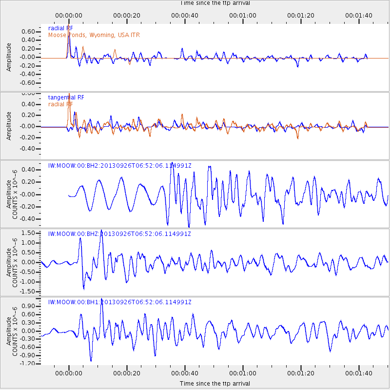
MOOW Moose Ponds, Wyoming, USA - Earthquake Result Viewer
*The percent match for this event was below the threshold and hence no stack was calculated.
| Earthquake location: |
Near Coast Of Chiapas, Mexico |
| Earthquake latitude/longitude: |
14.4/-93.4 |
| Earthquake time(UTC): |
2013/09/26 (269) 06:46:03 GMT |
| Earthquake Depth: |
8.8 km |
| Earthquake Magnitude: |
5.5 MWB, 5.7 MWC |
| Earthquake Catalog/Contributor: |
NEIC PDE/NEIC COMCAT |
|
| Network: |
IW Intermountain West |
| Station: |
MOOW Moose Ponds, Wyoming, USA |
| Lat/Lon: |
43.75 N/110.74 W |
| Elevation: |
2128 m |
|
| Distance: |
32.8 deg |
| Az: |
336.456 deg |
| Baz: |
147.723 deg |
| Ray Param: |
$rayparam |
*The percent match for this event was below the threshold and hence was not used in the summary stack. |
|
| Radial Match: |
72.83839 % |
| Radial Bump: |
365 |
| Transverse Match: |
65.63462 % |
| Transverse Bump: |
335 |
| SOD ConfigId: |
626651 |
| Insert Time: |
2014-04-18 21:09:10.359 +0000 |
| GWidth: |
2.5 |
| Max Bumps: |
400 |
| Tol: |
0.001 |
|
Signal To Noise
| Channel | StoN | STA | LTA |
| IW:MOOW:00:BHZ:20130926T06:52:06.114991Z | 4.5482545 | 4.6519128E-7 | 1.02279074E-7 |
| IW:MOOW:00:BH1:20130926T06:52:06.114991Z | 1.8446712 | 2.4581635E-7 | 1.3325754E-7 |
| IW:MOOW:00:BH2:20130926T06:52:06.114991Z | 1.2610401 | 1.959816E-7 | 1.5541266E-7 |
| Arrivals |
| Ps | |
| PpPs | |
| PsPs/PpSs | |


