You are here: Home > Network List > IW - Intermountain West Stations List
> Station PLID Pearl Lake, Idaho, USA > Earthquake Result Viewer
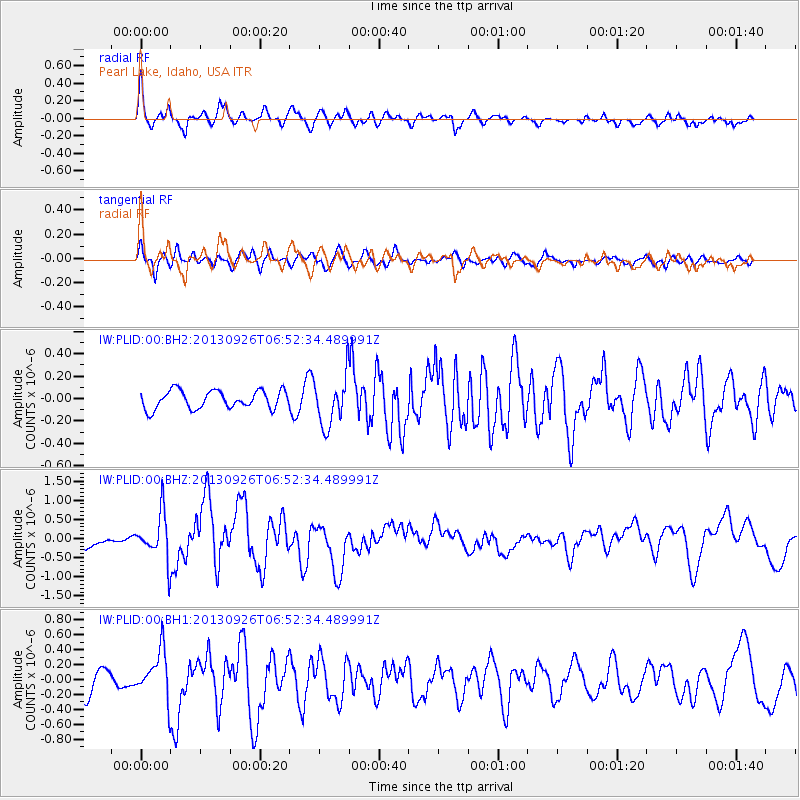
PLID Pearl Lake, Idaho, USA - Earthquake Result Viewer
*The percent match for this event was below the threshold and hence no stack was calculated.
| Earthquake location: |
Near Coast Of Chiapas, Mexico |
| Earthquake latitude/longitude: |
14.4/-93.4 |
| Earthquake time(UTC): |
2013/09/26 (269) 06:46:03 GMT |
| Earthquake Depth: |
8.8 km |
| Earthquake Magnitude: |
5.5 MWB, 5.7 MWC |
| Earthquake Catalog/Contributor: |
NEIC PDE/NEIC COMCAT |
|
| Network: |
IW Intermountain West |
| Station: |
PLID Pearl Lake, Idaho, USA |
| Lat/Lon: |
45.09 N/116.00 W |
| Elevation: |
2164 m |
|
| Distance: |
36.1 deg |
| Az: |
332.434 deg |
| Baz: |
140.736 deg |
| Ray Param: |
$rayparam |
*The percent match for this event was below the threshold and hence was not used in the summary stack. |
|
| Radial Match: |
77.20724 % |
| Radial Bump: |
400 |
| Transverse Match: |
66.0407 % |
| Transverse Bump: |
400 |
| SOD ConfigId: |
626651 |
| Insert Time: |
2014-04-18 21:09:11.053 +0000 |
| GWidth: |
2.5 |
| Max Bumps: |
400 |
| Tol: |
0.001 |
|
Signal To Noise
| Channel | StoN | STA | LTA |
| IW:PLID:00:BHZ:20130926T06:52:34.489991Z | 3.5905633 | 5.9634846E-7 | 1.6608772E-7 |
| IW:PLID:00:BH1:20130926T06:52:34.489991Z | 2.2225142 | 3.1554902E-7 | 1.419784E-7 |
| IW:PLID:00:BH2:20130926T06:52:34.489991Z | 2.7378879 | 2.2130777E-7 | 8.083156E-8 |
| Arrivals |
| Ps | |
| PpPs | |
| PsPs/PpSs | |


