You are here: Home > Network List > TA - USArray Transportable Network (new EarthScope stations) Stations List
> Station E51A G1948 Merrick Township, ON, CAN > Earthquake Result Viewer
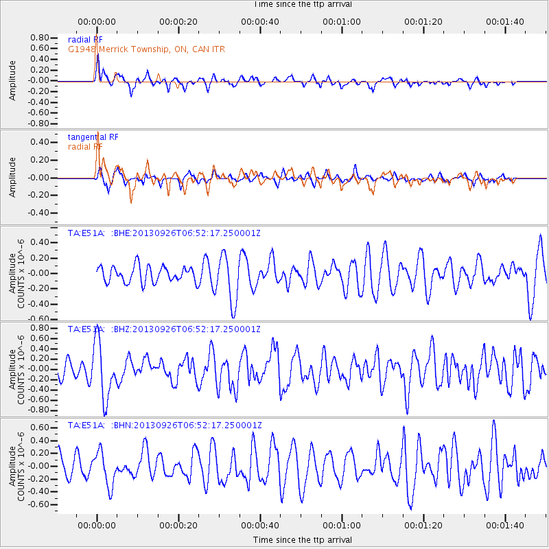
E51A G1948 Merrick Township, ON, CAN - Earthquake Result Viewer
*The percent match for this event was below the threshold and hence no stack was calculated.
| Earthquake location: |
Near Coast Of Chiapas, Mexico |
| Earthquake latitude/longitude: |
14.4/-93.4 |
| Earthquake time(UTC): |
2013/09/26 (269) 06:46:03 GMT |
| Earthquake Depth: |
8.8 km |
| Earthquake Magnitude: |
5.5 MWB, 5.7 MWC |
| Earthquake Catalog/Contributor: |
NEIC PDE/NEIC COMCAT |
|
| Network: |
TA USArray Transportable Network (new EarthScope stations) |
| Station: |
E51A G1948 Merrick Township, ON, CAN |
| Lat/Lon: |
46.53 N/79.49 W |
| Elevation: |
369 m |
|
| Distance: |
34.1 deg |
| Az: |
17.219 deg |
| Baz: |
204.546 deg |
| Ray Param: |
$rayparam |
*The percent match for this event was below the threshold and hence was not used in the summary stack. |
|
| Radial Match: |
64.21187 % |
| Radial Bump: |
393 |
| Transverse Match: |
49.970215 % |
| Transverse Bump: |
328 |
| SOD ConfigId: |
626651 |
| Insert Time: |
2014-04-18 21:14:19.487 +0000 |
| GWidth: |
2.5 |
| Max Bumps: |
400 |
| Tol: |
0.001 |
|
Signal To Noise
| Channel | StoN | STA | LTA |
| TA:E51A: :BHZ:20130926T06:52:17.250001Z | 3.4532378 | 5.612878E-7 | 1.6253956E-7 |
| TA:E51A: :BHN:20130926T06:52:17.250001Z | 1.7284555 | 2.7143628E-7 | 1.5703978E-7 |
| TA:E51A: :BHE:20130926T06:52:17.250001Z | 3.0647397 | 3.1397357E-7 | 1.0244706E-7 |
| Arrivals |
| Ps | |
| PpPs | |
| PsPs/PpSs | |


