You are here: Home > Network List > TA - USArray Transportable Network (new EarthScope stations) Stations List
> Station I46A Reed City, MI, USA > Earthquake Result Viewer
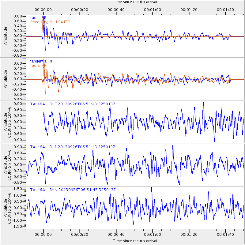
I46A Reed City, MI, USA - Earthquake Result Viewer
*The percent match for this event was below the threshold and hence no stack was calculated.
| Earthquake location: |
Near Coast Of Chiapas, Mexico |
| Earthquake latitude/longitude: |
14.4/-93.4 |
| Earthquake time(UTC): |
2013/09/26 (269) 06:46:03 GMT |
| Earthquake Depth: |
8.8 km |
| Earthquake Magnitude: |
5.5 MWB, 5.7 MWC |
| Earthquake Catalog/Contributor: |
NEIC PDE/NEIC COMCAT |
|
| Network: |
TA USArray Transportable Network (new EarthScope stations) |
| Station: |
I46A Reed City, MI, USA |
| Lat/Lon: |
43.94 N/85.45 W |
| Elevation: |
359 m |
|
| Distance: |
30.2 deg |
| Az: |
11.447 deg |
| Baz: |
195.437 deg |
| Ray Param: |
$rayparam |
*The percent match for this event was below the threshold and hence was not used in the summary stack. |
|
| Radial Match: |
63.20947 % |
| Radial Bump: |
400 |
| Transverse Match: |
45.208168 % |
| Transverse Bump: |
400 |
| SOD ConfigId: |
626651 |
| Insert Time: |
2014-04-18 21:16:21.225 +0000 |
| GWidth: |
2.5 |
| Max Bumps: |
400 |
| Tol: |
0.001 |
|
Signal To Noise
| Channel | StoN | STA | LTA |
| TA:I46A: :BHZ:20130926T06:51:43.325013Z | 1.7071532 | 4.1855816E-7 | 2.4517902E-7 |
| TA:I46A: :BHN:20130926T06:51:43.325013Z | 2.2737496 | 5.91313E-7 | 2.6006072E-7 |
| TA:I46A: :BHE:20130926T06:51:43.325013Z | 1.0778155 | 3.3481675E-7 | 3.1064383E-7 |
| Arrivals |
| Ps | |
| PpPs | |
| PsPs/PpSs | |


