You are here: Home > Network List > US - United States National Seismic Network Stations List
> Station BW06 Boulder Array Site 6 (Pinedale), Wyoming, USA > Earthquake Result Viewer
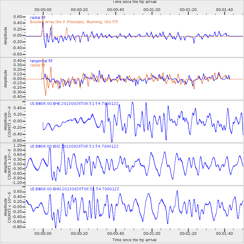
BW06 Boulder Array Site 6 (Pinedale), Wyoming, USA - Earthquake Result Viewer
*The percent match for this event was below the threshold and hence no stack was calculated.
| Earthquake location: |
Near Coast Of Chiapas, Mexico |
| Earthquake latitude/longitude: |
14.4/-93.4 |
| Earthquake time(UTC): |
2013/09/26 (269) 06:46:03 GMT |
| Earthquake Depth: |
8.8 km |
| Earthquake Magnitude: |
5.5 MWB, 5.7 MWC |
| Earthquake Catalog/Contributor: |
NEIC PDE/NEIC COMCAT |
|
| Network: |
US United States National Seismic Network |
| Station: |
BW06 Boulder Array Site 6 (Pinedale), Wyoming, USA |
| Lat/Lon: |
42.77 N/109.56 W |
| Elevation: |
2224 m |
|
| Distance: |
31.5 deg |
| Az: |
336.873 deg |
| Baz: |
148.887 deg |
| Ray Param: |
$rayparam |
*The percent match for this event was below the threshold and hence was not used in the summary stack. |
|
| Radial Match: |
57.98769 % |
| Radial Bump: |
400 |
| Transverse Match: |
54.575912 % |
| Transverse Bump: |
400 |
| SOD ConfigId: |
626651 |
| Insert Time: |
2014-04-18 21:19:08.645 +0000 |
| GWidth: |
2.5 |
| Max Bumps: |
400 |
| Tol: |
0.001 |
|
Signal To Noise
| Channel | StoN | STA | LTA |
| US:BW06:00:BHZ:20130926T06:51:54.799012Z | 2.6338265 | 4.7228502E-7 | 1.7931517E-7 |
| US:BW06:00:BHN:20130926T06:51:54.799012Z | 2.3141775 | 2.7280166E-7 | 1.1788277E-7 |
| US:BW06:00:BHE:20130926T06:51:54.799012Z | 1.8621323 | 1.9122702E-7 | 1.02692496E-7 |
| Arrivals |
| Ps | |
| PpPs | |
| PsPs/PpSs | |


