GAMB Gambell Broadband - Earthquake Result Viewer
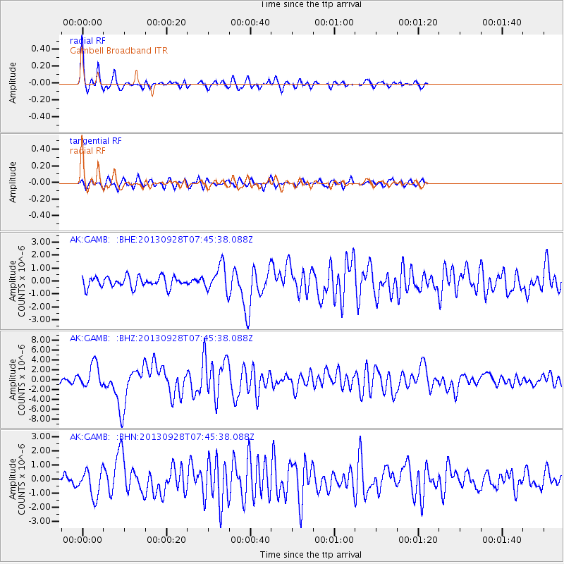
Earthquake location: Pakistan
Earthquake latitude/longitude: 27.2/65.5
Earthquake time(UTC): 2013/09/28 (271) 07:34:06 GMT
Earthquake Depth: 12 km
Earthquake Magnitude: 6.8 MWW, 6.8 MWW, 6.8 MWC, 6.8 MWB, 6.9 MWC
Earthquake Catalog/Contributor: NEIC PDE/NEIC COMCAT
Network: AK Alaska Regional Network
Station: GAMB Gambell Broadband
Lat/Lon: 63.78 N/171.70 W
Elevation: 10 m
Distance: 78.9 deg
Az: 22.371 deg
Baz: 310.259 deg
Ray Param: 0.049333807
Estimated Moho Depth: 22.5 km
Estimated Crust Vp/Vs: 2.05
Assumed Crust Vp: 6.24 km/s
Estimated Crust Vs: 3.044 km/s
Estimated Crust Poisson's Ratio: 0.34
Radial Match: 89.637245 %
Radial Bump: 311
Transverse Match: 71.72255 %
Transverse Bump: 400
SOD ConfigId: 626651
Insert Time: 2014-04-18 21:23:27.955 +0000
GWidth: 2.5
Max Bumps: 400
Tol: 0.001

Signal To Noise

ChannelStoNSTALTA
AK:GAMB: :BHZ:20130928T07:45:38.088Z7.16479642.4598E-63.433175E-7
AK:GAMB: :BHN:20130928T07:45:38.088Z3.07944189.544246E-73.099343E-7
AK:GAMB: :BHE:20130928T07:45:38.088Z2.49697731.0223697E-64.094429E-7
Arrivals
Ps3.9 SECOND
PpPs11 SECOND
PsPs/PpSs15 SECOND