You are here: Home > Network List > CI - Caltech Regional Seismic Network Stations List
> Station TIN Tinemaha, California, USA > Earthquake Result Viewer
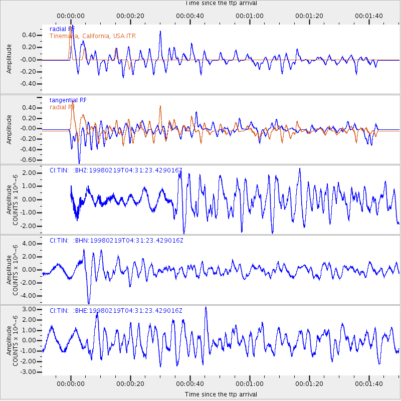
TIN Tinemaha, California, USA - Earthquake Result Viewer
*The percent match for this event was below the threshold and hence no stack was calculated.
| Earthquake location: |
Central Peru |
| Earthquake latitude/longitude: |
-11.0/-74.4 |
| Earthquake time(UTC): |
1998/02/19 (050) 04:21:30 GMT |
| Earthquake Depth: |
33 km |
| Earthquake Magnitude: |
5.8 MB, 5.4 MS, 6.0 UNKNOWN, 5.9 MW |
| Earthquake Catalog/Contributor: |
WHDF/NEIC |
|
| Network: |
CI Caltech Regional Seismic Network |
| Station: |
TIN Tinemaha, California, USA |
| Lat/Lon: |
37.05 N/118.23 W |
| Elevation: |
1164 m |
|
| Distance: |
63.0 deg |
| Az: |
321.595 deg |
| Baz: |
130.315 deg |
| Ray Param: |
$rayparam |
*The percent match for this event was below the threshold and hence was not used in the summary stack. |
|
| Radial Match: |
79.12058 % |
| Radial Bump: |
400 |
| Transverse Match: |
71.8498 % |
| Transverse Bump: |
400 |
| SOD ConfigId: |
4480 |
| Insert Time: |
2010-02-25 20:52:26.367 +0000 |
| GWidth: |
2.5 |
| Max Bumps: |
400 |
| Tol: |
0.001 |
|
Signal To Noise
| Channel | StoN | STA | LTA |
| CI:TIN: :BHN:19980219T04:31:23.429016Z | 2.2959843 | 1.3142961E-6 | 5.7243255E-7 |
| CI:TIN: :BHE:19980219T04:31:23.429016Z | 1.1134006 | 6.365196E-7 | 5.7168967E-7 |
| CI:TIN: :BHZ:19980219T04:31:23.429016Z | 1.256232 | 5.1590735E-7 | 4.1067838E-7 |
| Arrivals |
| Ps | |
| PpPs | |
| PsPs/PpSs | |


