TLY Talaya, Russia - Earthquake Result Viewer
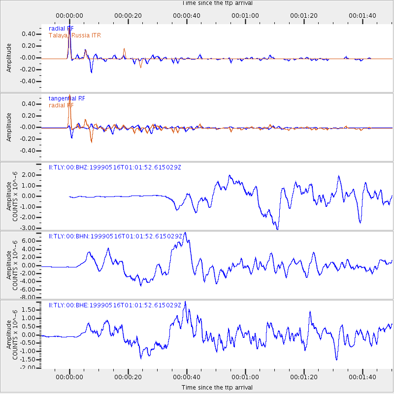
Earthquake location: New Britain Region, P.N.G.
Earthquake latitude/longitude: -4.8/152.5
Earthquake time(UTC): 1999/05/16 (136) 00:51:20 GMT
Earthquake Depth: 74 km
Earthquake Magnitude: 6.0 MB, 7.0 MS, 7.1 MW, 6.3 ME
Earthquake Catalog/Contributor: WHDF/NEIC
Network: II Global Seismograph Network (GSN - IRIS/IDA)
Station: TLY Talaya, Russia
Lat/Lon: 51.68 N/103.64 E
Elevation: 579 m
Distance: 69.9 deg
Az: 330.051 deg
Baz: 126.954 deg
Ray Param: 0.05518151
Estimated Moho Depth: 12.0 km
Estimated Crust Vp/Vs: 2.10
Assumed Crust Vp: 6.419 km/s
Estimated Crust Vs: 3.06 km/s
Estimated Crust Poisson's Ratio: 0.35
Radial Match: 97.91149 %
Radial Bump: 265
Transverse Match: 90.723045 %
Transverse Bump: 400
SOD ConfigId: 4480
Insert Time: 2010-03-01 17:01:14.276 +0000
GWidth: 2.5
Max Bumps: 400
Tol: 0.001

Signal To Noise

ChannelStoNSTALTA
II:TLY:00:BHN:19990516T01:01:52.615029Z4.0290683.7570695E-79.324909E-8
II:TLY:00:BHE:19990516T01:01:52.615029Z2.69084148.2527805E-83.0669888E-8
II:TLY:00:BHZ:19990516T01:01:52.615029Z2.62733151.1782023E-74.4844064E-8
Arrivals
Ps2.1 SECOND
PpPs5.6 SECOND
PsPs/PpSs7.7 SECOND