You are here: Home > Network List > IW - Intermountain West Stations List
> Station IMW Indian Meadow, Wyoming, USA > Earthquake Result Viewer
IMW Indian Meadow, Wyoming, USA - Earthquake Result Viewer
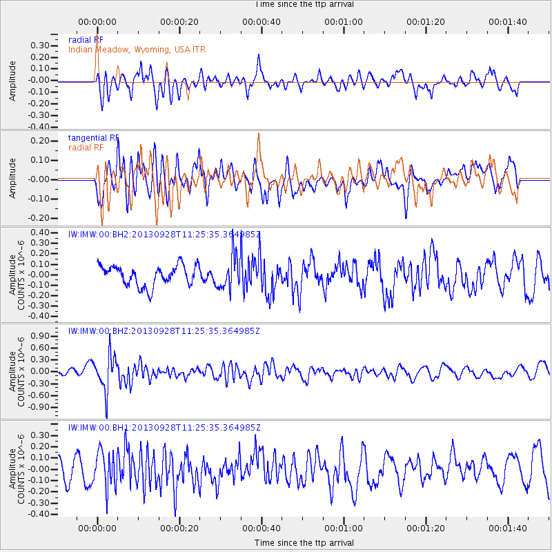
*The percent match for this event was below the threshold and hence no stack was calculated.
| Earthquake location: |
Tonga Islands |
| Earthquake latitude/longitude: |
-16.6/-173.8 |
| Earthquake time(UTC): |
2013/09/28 (271) 11:13:47 GMT |
| Earthquake Depth: |
59 km |
| Earthquake Magnitude: |
5.5 MWC, 5.5 MWC |
| Earthquake Catalog/Contributor: |
NEIC PDE/NEIC COMCAT |
|
| Network: |
IW Intermountain West |
| Station: |
IMW Indian Meadow, Wyoming, USA |
| Lat/Lon: |
43.90 N/110.94 W |
| Elevation: |
2646 m |
|
| Distance: |
83.1 deg |
| Az: |
40.408 deg |
| Baz: |
239.318 deg |
| Ray Param: |
$rayparam |
*The percent match for this event was below the threshold and hence was not used in the summary stack. |
|
| Radial Match: |
61.712044 % |
| Radial Bump: |
400 |
| Transverse Match: |
62.088993 % |
| Transverse Bump: |
400 |
| SOD ConfigId: |
626651 |
| Insert Time: |
2014-04-18 21:46:19.022 +0000 |
| GWidth: |
2.5 |
| Max Bumps: |
400 |
| Tol: |
0.001 |
|
Signal To Noise
| Channel | StoN | STA | LTA |
| IW:IMW:00:BHZ:20130928T11:25:35.364985Z | 3.5286152 | 4.502297E-7 | 1.2759388E-7 |
| IW:IMW:00:BH1:20130928T11:25:35.364985Z | 1.2626497 | 1.609838E-7 | 1.2749682E-7 |
| IW:IMW:00:BH2:20130928T11:25:35.364985Z | 1.6874164 | 1.6384303E-7 | 9.709697E-8 |
| Arrivals |
| Ps | |
| PpPs | |
| PsPs/PpSs | |


