You are here: Home > Network List > TA - USArray Transportable Network (new EarthScope stations) Stations List
> Station 833A Chaparral WMA, Artesia Wells, TX, USA > Earthquake Result Viewer
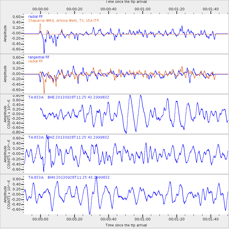
833A Chaparral WMA, Artesia Wells, TX, USA - Earthquake Result Viewer
*The percent match for this event was below the threshold and hence no stack was calculated.
| Earthquake location: |
Tonga Islands |
| Earthquake latitude/longitude: |
-16.6/-173.8 |
| Earthquake time(UTC): |
2013/09/28 (271) 11:13:47 GMT |
| Earthquake Depth: |
59 km |
| Earthquake Magnitude: |
5.5 MWC, 5.5 MWC |
| Earthquake Catalog/Contributor: |
NEIC PDE/NEIC COMCAT |
|
| Network: |
TA USArray Transportable Network (new EarthScope stations) |
| Station: |
833A Chaparral WMA, Artesia Wells, TX, USA |
| Lat/Lon: |
28.32 N/99.39 W |
| Elevation: |
171 m |
|
| Distance: |
84.7 deg |
| Az: |
58.541 deg |
| Baz: |
248.123 deg |
| Ray Param: |
$rayparam |
*The percent match for this event was below the threshold and hence was not used in the summary stack. |
|
| Radial Match: |
70.473694 % |
| Radial Bump: |
400 |
| Transverse Match: |
66.15081 % |
| Transverse Bump: |
349 |
| SOD ConfigId: |
626651 |
| Insert Time: |
2014-04-18 21:50:42.170 +0000 |
| GWidth: |
2.5 |
| Max Bumps: |
400 |
| Tol: |
0.001 |
|
Signal To Noise
| Channel | StoN | STA | LTA |
| TA:833A: :BHZ:20130928T11:25:43.299983Z | 2.1113105 | 4.0011943E-7 | 1.8951236E-7 |
| TA:833A: :BHN:20130928T11:25:43.299983Z | 1.0270361 | 1.372904E-7 | 1.3367631E-7 |
| TA:833A: :BHE:20130928T11:25:43.299983Z | 2.1884296 | 2.9402463E-7 | 1.3435417E-7 |
| Arrivals |
| Ps | |
| PpPs | |
| PsPs/PpSs | |


