You are here: Home > Network List > WY - Yellowstone Wyoming Seismic Network Stations List
> Station YHH Holmes Hill, YNP, WY, USA > Earthquake Result Viewer
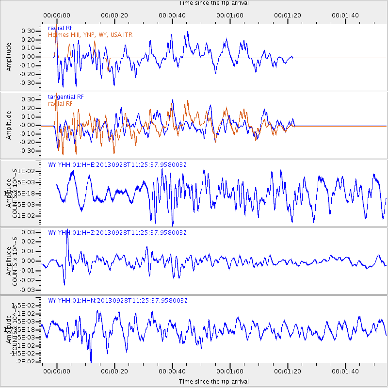
YHH Holmes Hill, YNP, WY, USA - Earthquake Result Viewer
*The percent match for this event was below the threshold and hence no stack was calculated.
| Earthquake location: |
Tonga Islands |
| Earthquake latitude/longitude: |
-16.6/-173.8 |
| Earthquake time(UTC): |
2013/09/28 (271) 11:13:47 GMT |
| Earthquake Depth: |
59 km |
| Earthquake Magnitude: |
5.5 MWC, 5.5 MWC |
| Earthquake Catalog/Contributor: |
NEIC PDE/NEIC COMCAT |
|
| Network: |
WY Yellowstone Wyoming Seismic Network |
| Station: |
YHH Holmes Hill, YNP, WY, USA |
| Lat/Lon: |
44.79 N/110.85 W |
| Elevation: |
2717 m |
|
| Distance: |
83.6 deg |
| Az: |
39.67 deg |
| Baz: |
239.294 deg |
| Ray Param: |
$rayparam |
*The percent match for this event was below the threshold and hence was not used in the summary stack. |
|
| Radial Match: |
67.88329 % |
| Radial Bump: |
388 |
| Transverse Match: |
60.900146 % |
| Transverse Bump: |
398 |
| SOD ConfigId: |
626651 |
| Insert Time: |
2014-04-18 21:55:36.269 +0000 |
| GWidth: |
2.5 |
| Max Bumps: |
400 |
| Tol: |
0.001 |
|
Signal To Noise
| Channel | StoN | STA | LTA |
| WY:YHH:01:HHZ:20130928T11:25:37.958003Z | 3.127744 | 1.2282483E-8 | 3.9269463E-9 |
| WY:YHH:01:HHN:20130928T11:25:37.958003Z | 1.2556312 | 3.6350887E-9 | 2.8950289E-9 |
| WY:YHH:01:HHE:20130928T11:25:37.958003Z | 1.5182333 | 5.8938867E-9 | 3.8820693E-9 |
| Arrivals |
| Ps | |
| PpPs | |
| PsPs/PpSs | |


