TLY Talaya, Russia - Earthquake Result Viewer
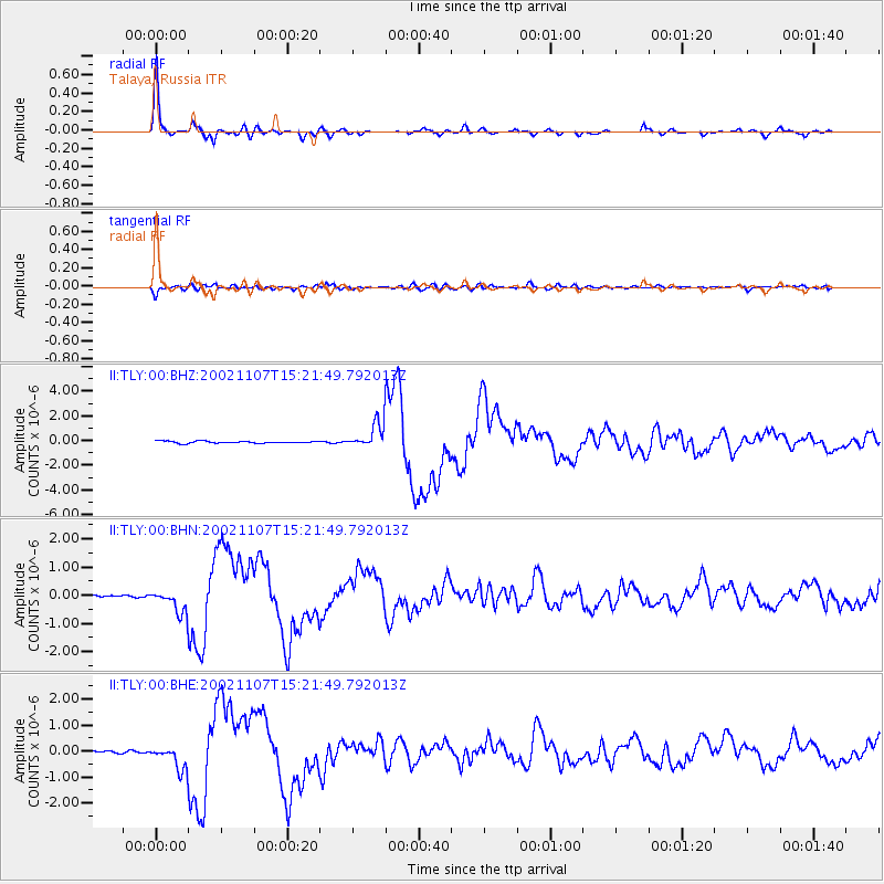
Earthquake location: Rat Islands, Aleutian Islands
Earthquake latitude/longitude: 51.2/179.3
Earthquake time(UTC): 2002/11/07 (311) 15:14:06 GMT
Earthquake Depth: 33 km
Earthquake Magnitude: 5.8 MB, 6.4 MS, 6.6 MW, 6.5 MW
Earthquake Catalog/Contributor: WHDF/NEIC
Network: II Global Seismograph Network (GSN - IRIS/IDA)
Station: TLY Talaya, Russia
Lat/Lon: 51.68 N/103.64 E
Elevation: 579 m
Distance: 45.2 deg
Az: 301.711 deg
Baz: 59.285 deg
Ray Param: 0.07138924
Estimated Moho Depth: 43.5 km
Estimated Crust Vp/Vs: 1.79
Assumed Crust Vp: 6.419 km/s
Estimated Crust Vs: 3.581 km/s
Estimated Crust Poisson's Ratio: 0.27
Radial Match: 97.19828 %
Radial Bump: 253
Transverse Match: 83.873245 %
Transverse Bump: 400
SOD ConfigId: 4714
Insert Time: 2010-03-01 17:02:56.099 +0000
GWidth: 2.5
Max Bumps: 400
Tol: 0.001

Signal To Noise

ChannelStoNSTALTA
II:TLY:00:BHN:20021107T15:21:49.792013Z7.87506634.00902E-75.090776E-8
II:TLY:00:BHE:20021107T15:21:49.792013Z12.0185094.4337227E-73.689079E-8
II:TLY:00:BHZ:20021107T15:21:49.792013Z11.8614561.0031808E-68.457485E-8
Arrivals
Ps5.7 SECOND
PpPs18 SECOND
PsPs/PpSs23 SECOND