You are here: Home > Network List > TA - USArray Transportable Network (new EarthScope stations) Stations List
> Station J49A Marlette, MI, USA > Earthquake Result Viewer
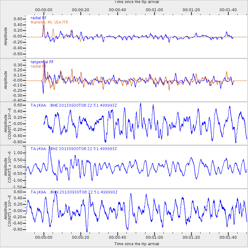
J49A Marlette, MI, USA - Earthquake Result Viewer
*The percent match for this event was below the threshold and hence no stack was calculated.
| Earthquake location: |
Northern Mid-Atlantic Ridge |
| Earthquake latitude/longitude: |
49.5/-28.5 |
| Earthquake time(UTC): |
2013/09/30 (273) 08:16:09 GMT |
| Earthquake Depth: |
10 km |
| Earthquake Magnitude: |
5.5 MWC, 5.5 MWC |
| Earthquake Catalog/Contributor: |
NEIC PDE/NEIC COMCAT |
|
| Network: |
TA USArray Transportable Network (new EarthScope stations) |
| Station: |
J49A Marlette, MI, USA |
| Lat/Lon: |
43.36 N/83.14 W |
| Elevation: |
253 m |
|
| Distance: |
37.4 deg |
| Az: |
281.951 deg |
| Baz: |
61.0 deg |
| Ray Param: |
$rayparam |
*The percent match for this event was below the threshold and hence was not used in the summary stack. |
|
| Radial Match: |
57.48129 % |
| Radial Bump: |
372 |
| Transverse Match: |
54.857407 % |
| Transverse Bump: |
400 |
| SOD ConfigId: |
626651 |
| Insert Time: |
2014-04-18 22:33:53.916 +0000 |
| GWidth: |
2.5 |
| Max Bumps: |
400 |
| Tol: |
0.001 |
|
Signal To Noise
| Channel | StoN | STA | LTA |
| TA:J49A: :BHZ:20130930T08:22:51.499993Z | 2.2352018 | 6.072075E-7 | 2.7165666E-7 |
| TA:J49A: :BHN:20130930T08:22:51.499993Z | 1.1378193 | 3.012695E-7 | 2.64778E-7 |
| TA:J49A: :BHE:20130930T08:22:51.499993Z | 1.4107518 | 2.8416153E-7 | 2.0142559E-7 |
| Arrivals |
| Ps | |
| PpPs | |
| PsPs/PpSs | |


