You are here: Home > Network List > TA - USArray Transportable Network (new EarthScope stations) Stations List
> Station N23A Red Feather Lakes, CO, USA > Earthquake Result Viewer
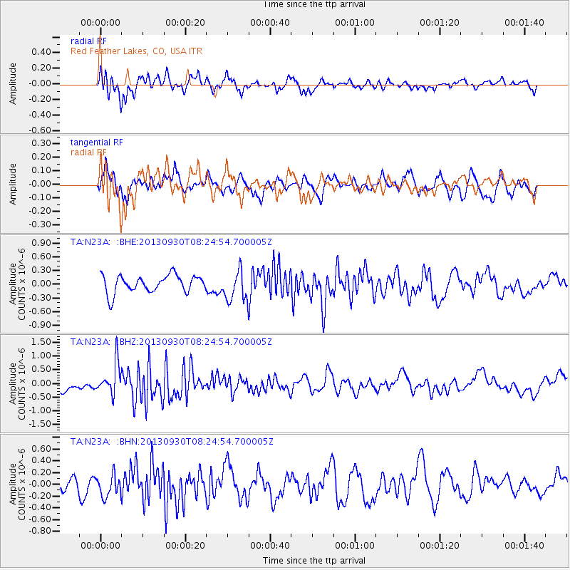
N23A Red Feather Lakes, CO, USA - Earthquake Result Viewer
*The percent match for this event was below the threshold and hence no stack was calculated.
| Earthquake location: |
Northern Mid-Atlantic Ridge |
| Earthquake latitude/longitude: |
49.5/-28.5 |
| Earthquake time(UTC): |
2013/09/30 (273) 08:16:09 GMT |
| Earthquake Depth: |
10 km |
| Earthquake Magnitude: |
5.5 MWC, 5.5 MWC |
| Earthquake Catalog/Contributor: |
NEIC PDE/NEIC COMCAT |
|
| Network: |
TA USArray Transportable Network (new EarthScope stations) |
| Station: |
N23A Red Feather Lakes, CO, USA |
| Lat/Lon: |
40.89 N/105.94 W |
| Elevation: |
2458 m |
|
| Distance: |
53.0 deg |
| Az: |
292.074 deg |
| Baz: |
52.851 deg |
| Ray Param: |
$rayparam |
*The percent match for this event was below the threshold and hence was not used in the summary stack. |
|
| Radial Match: |
68.62383 % |
| Radial Bump: |
400 |
| Transverse Match: |
53.82824 % |
| Transverse Bump: |
400 |
| SOD ConfigId: |
626651 |
| Insert Time: |
2014-04-18 22:35:33.375 +0000 |
| GWidth: |
2.5 |
| Max Bumps: |
400 |
| Tol: |
0.001 |
|
Signal To Noise
| Channel | StoN | STA | LTA |
| TA:N23A: :BHZ:20130930T08:24:54.700005Z | 3.2521632 | 5.768563E-7 | 1.7737618E-7 |
| TA:N23A: :BHN:20130930T08:24:54.700005Z | 1.580323 | 1.8467581E-7 | 1.1685953E-7 |
| TA:N23A: :BHE:20130930T08:24:54.700005Z | 1.7954772 | 3.4216163E-7 | 1.9056864E-7 |
| Arrivals |
| Ps | |
| PpPs | |
| PsPs/PpSs | |


