You are here: Home > Network List > TA - USArray Transportable Network (new EarthScope stations) Stations List
> Station S49A Springfield, KY, USA > Earthquake Result Viewer
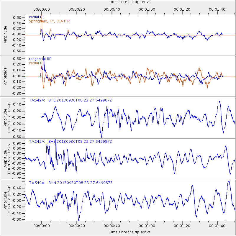
S49A Springfield, KY, USA - Earthquake Result Viewer
*The percent match for this event was below the threshold and hence no stack was calculated.
| Earthquake location: |
Northern Mid-Atlantic Ridge |
| Earthquake latitude/longitude: |
49.5/-28.5 |
| Earthquake time(UTC): |
2013/09/30 (273) 08:16:09 GMT |
| Earthquake Depth: |
10 km |
| Earthquake Magnitude: |
5.5 MWC, 5.5 MWC |
| Earthquake Catalog/Contributor: |
NEIC PDE/NEIC COMCAT |
|
| Network: |
TA USArray Transportable Network (new EarthScope stations) |
| Station: |
S49A Springfield, KY, USA |
| Lat/Lon: |
37.78 N/85.29 W |
| Elevation: |
230 m |
|
| Distance: |
41.8 deg |
| Az: |
275.908 deg |
| Baz: |
54.944 deg |
| Ray Param: |
$rayparam |
*The percent match for this event was below the threshold and hence was not used in the summary stack. |
|
| Radial Match: |
53.859535 % |
| Radial Bump: |
400 |
| Transverse Match: |
61.16539 % |
| Transverse Bump: |
379 |
| SOD ConfigId: |
626651 |
| Insert Time: |
2014-04-18 22:37:30.969 +0000 |
| GWidth: |
2.5 |
| Max Bumps: |
400 |
| Tol: |
0.001 |
|
Signal To Noise
| Channel | StoN | STA | LTA |
| TA:S49A: :BHZ:20130930T08:23:27.649987Z | 2.831645 | 4.6333315E-7 | 1.6362685E-7 |
| TA:S49A: :BHN:20130930T08:23:27.649987Z | 0.71145195 | 1.3047026E-7 | 1.833859E-7 |
| TA:S49A: :BHE:20130930T08:23:27.649987Z | 1.7125938 | 2.9807956E-7 | 1.7405152E-7 |
| Arrivals |
| Ps | |
| PpPs | |
| PsPs/PpSs | |


