You are here: Home > Network List > TA - USArray Transportable Network (new EarthScope stations) Stations List
> Station T57A Hurt, VA, USA > Earthquake Result Viewer
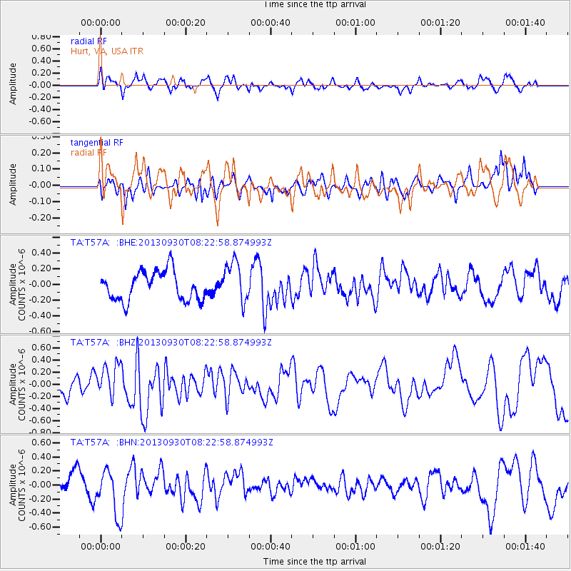
T57A Hurt, VA, USA - Earthquake Result Viewer
*The percent match for this event was below the threshold and hence no stack was calculated.
| Earthquake location: |
Northern Mid-Atlantic Ridge |
| Earthquake latitude/longitude: |
49.5/-28.5 |
| Earthquake time(UTC): |
2013/09/30 (273) 08:16:09 GMT |
| Earthquake Depth: |
10 km |
| Earthquake Magnitude: |
5.5 MWC, 5.5 MWC |
| Earthquake Catalog/Contributor: |
NEIC PDE/NEIC COMCAT |
|
| Network: |
TA USArray Transportable Network (new EarthScope stations) |
| Station: |
T57A Hurt, VA, USA |
| Lat/Lon: |
37.00 N/79.25 W |
| Elevation: |
230 m |
|
| Distance: |
38.3 deg |
| Az: |
270.6 deg |
| Baz: |
54.528 deg |
| Ray Param: |
$rayparam |
*The percent match for this event was below the threshold and hence was not used in the summary stack. |
|
| Radial Match: |
65.33485 % |
| Radial Bump: |
400 |
| Transverse Match: |
69.635414 % |
| Transverse Bump: |
400 |
| SOD ConfigId: |
626651 |
| Insert Time: |
2014-04-18 22:38:00.742 +0000 |
| GWidth: |
2.5 |
| Max Bumps: |
400 |
| Tol: |
0.001 |
|
Signal To Noise
| Channel | StoN | STA | LTA |
| TA:T57A: :BHZ:20130930T08:22:58.874993Z | 1.4482924 | 2.7809875E-7 | 1.9201839E-7 |
| TA:T57A: :BHN:20130930T08:22:58.874993Z | 2.3642077 | 3.3574494E-7 | 1.4201161E-7 |
| TA:T57A: :BHE:20130930T08:22:58.874993Z | 1.4581921 | 2.6963022E-7 | 1.849072E-7 |
| Arrivals |
| Ps | |
| PpPs | |
| PsPs/PpSs | |


