You are here: Home > Network List > TA - USArray Transportable Network (new EarthScope stations) Stations List
> Station W41B Gary Mavity, Velonia, AR, USA > Earthquake Result Viewer
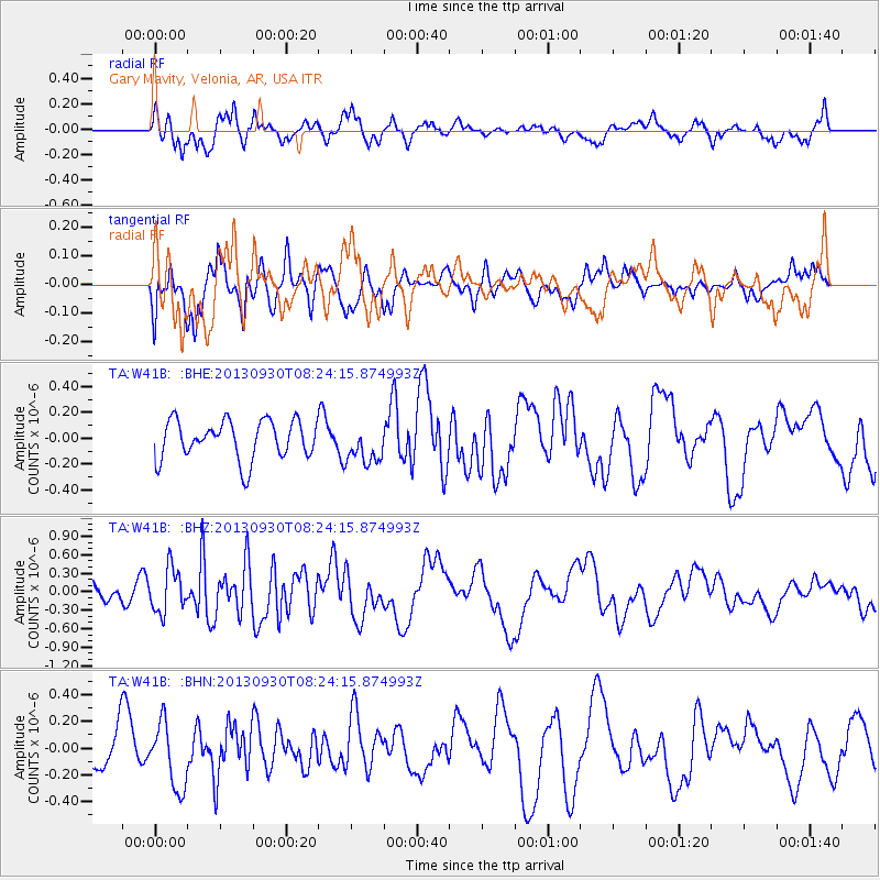
W41B Gary Mavity, Velonia, AR, USA - Earthquake Result Viewer
*The percent match for this event was below the threshold and hence no stack was calculated.
| Earthquake location: |
Northern Mid-Atlantic Ridge |
| Earthquake latitude/longitude: |
49.5/-28.5 |
| Earthquake time(UTC): |
2013/09/30 (273) 08:16:09 GMT |
| Earthquake Depth: |
10 km |
| Earthquake Magnitude: |
5.5 MWC, 5.5 MWC |
| Earthquake Catalog/Contributor: |
NEIC PDE/NEIC COMCAT |
|
| Network: |
TA USArray Transportable Network (new EarthScope stations) |
| Station: |
W41B Gary Mavity, Velonia, AR, USA |
| Lat/Lon: |
35.17 N/92.25 W |
| Elevation: |
95 m |
|
| Distance: |
47.8 deg |
| Az: |
277.672 deg |
| Baz: |
52.073 deg |
| Ray Param: |
$rayparam |
*The percent match for this event was below the threshold and hence was not used in the summary stack. |
|
| Radial Match: |
70.8191 % |
| Radial Bump: |
400 |
| Transverse Match: |
67.74919 % |
| Transverse Bump: |
400 |
| SOD ConfigId: |
626651 |
| Insert Time: |
2014-04-18 22:38:51.828 +0000 |
| GWidth: |
2.5 |
| Max Bumps: |
400 |
| Tol: |
0.001 |
|
Signal To Noise
| Channel | StoN | STA | LTA |
| TA:W41B: :BHZ:20130930T08:24:15.874993Z | 2.1774158 | 3.5647489E-7 | 1.6371465E-7 |
| TA:W41B: :BHN:20130930T08:24:15.874993Z | 1.3363785 | 2.458362E-7 | 1.8395701E-7 |
| TA:W41B: :BHE:20130930T08:24:15.874993Z | 0.99878585 | 1.4980867E-7 | 1.4999078E-7 |
| Arrivals |
| Ps | |
| PpPs | |
| PsPs/PpSs | |


