You are here: Home > Network List > US - United States National Seismic Network Stations List
> Station AMTX Amarillo, Texas, USA > Earthquake Result Viewer
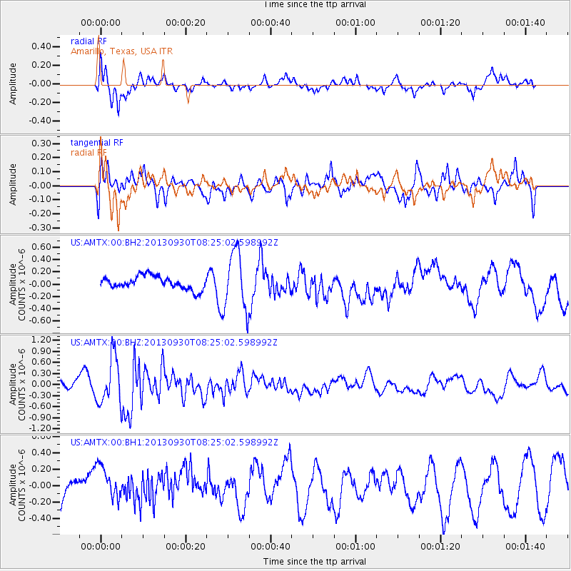
AMTX Amarillo, Texas, USA - Earthquake Result Viewer
*The percent match for this event was below the threshold and hence no stack was calculated.
| Earthquake location: |
Northern Mid-Atlantic Ridge |
| Earthquake latitude/longitude: |
49.5/-28.5 |
| Earthquake time(UTC): |
2013/09/30 (273) 08:16:09 GMT |
| Earthquake Depth: |
10 km |
| Earthquake Magnitude: |
5.5 MWC, 5.5 MWC |
| Earthquake Catalog/Contributor: |
NEIC PDE/NEIC COMCAT |
|
| Network: |
US United States National Seismic Network |
| Station: |
AMTX Amarillo, Texas, USA |
| Lat/Lon: |
34.53 N/101.41 W |
| Elevation: |
1010 m |
|
| Distance: |
54.1 deg |
| Az: |
283.105 deg |
| Baz: |
50.283 deg |
| Ray Param: |
$rayparam |
*The percent match for this event was below the threshold and hence was not used in the summary stack. |
|
| Radial Match: |
63.453373 % |
| Radial Bump: |
400 |
| Transverse Match: |
48.74769 % |
| Transverse Bump: |
400 |
| SOD ConfigId: |
626651 |
| Insert Time: |
2014-04-18 22:40:16.347 +0000 |
| GWidth: |
2.5 |
| Max Bumps: |
400 |
| Tol: |
0.001 |
|
Signal To Noise
| Channel | StoN | STA | LTA |
| US:AMTX:00:BHZ:20130930T08:25:02.598992Z | 3.4765444 | 6.495695E-7 | 1.8684344E-7 |
| US:AMTX:00:BH1:20130930T08:25:02.598992Z | 1.0941592 | 2.5353071E-7 | 2.317128E-7 |
| US:AMTX:00:BH2:20130930T08:25:02.598992Z | 4.544946 | 4.7621793E-7 | 1.04779666E-7 |
| Arrivals |
| Ps | |
| PpPs | |
| PsPs/PpSs | |


