You are here: Home > Network List > TA - USArray Transportable Network (new EarthScope stations) Stations List
> Station G59A Clarenceville, QC, USA > Earthquake Result Viewer
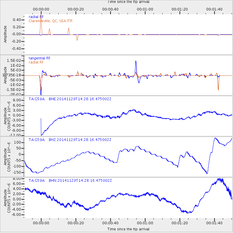
G59A Clarenceville, QC, USA - Earthquake Result Viewer
*The percent match for this event was below the threshold and hence no stack was calculated.
| Earthquake location: |
Near Coast Of Northern Chile |
| Earthquake latitude/longitude: |
-20.0/-71.0 |
| Earthquake time(UTC): |
2014/11/29 (333) 14:18:09 GMT |
| Earthquake Depth: |
15 km |
| Earthquake Magnitude: |
5.4 MW, 5.1 mb, 5.1 MS |
| Earthquake Catalog/Contributor: |
ISC/ISC |
|
| Network: |
TA USArray Transportable Network (new EarthScope stations) |
| Station: |
G59A Clarenceville, QC, USA |
| Lat/Lon: |
45.08 N/73.18 W |
| Elevation: |
36 m |
|
| Distance: |
64.8 deg |
| Az: |
358.28 deg |
| Baz: |
177.716 deg |
| Ray Param: |
$rayparam |
*The percent match for this event was below the threshold and hence was not used in the summary stack. |
|
| Radial Match: |
46.65653 % |
| Radial Bump: |
293 |
| Transverse Match: |
54.718704 % |
| Transverse Bump: |
400 |
| SOD ConfigId: |
3390531 |
| Insert Time: |
2019-04-15 05:59:43.004 +0000 |
| GWidth: |
2.5 |
| Max Bumps: |
400 |
| Tol: |
0.001 |
|
Signal To Noise
| Channel | StoN | STA | LTA |
| TA:G59A: :BHZ:20141129T14:28:16.475002Z | 1.1462648 | 3.552849E-4 | 3.099501E-4 |
| TA:G59A: :BHN:20141129T14:28:16.475002Z | 0.72364247 | 2.1836008E-6 | 3.0175136E-6 |
| TA:G59A: :BHE:20141129T14:28:16.475002Z | 0.7960285 | 2.9900327E-6 | 3.756188E-6 |
| Arrivals |
| Ps | |
| PpPs | |
| PsPs/PpSs | |


