You are here: Home > Network List > TA - USArray Transportable Network (new EarthScope stations) Stations List
> Station O03E Paynes Creek, CA, USA > Earthquake Result Viewer
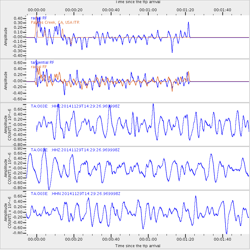
O03E Paynes Creek, CA, USA - Earthquake Result Viewer
*The percent match for this event was below the threshold and hence no stack was calculated.
| Earthquake location: |
Near Coast Of Northern Chile |
| Earthquake latitude/longitude: |
-20.0/-71.0 |
| Earthquake time(UTC): |
2014/11/29 (333) 14:18:09 GMT |
| Earthquake Depth: |
15 km |
| Earthquake Magnitude: |
5.4 MW, 5.1 mb, 5.1 MS |
| Earthquake Catalog/Contributor: |
ISC/ISC |
|
| Network: |
TA USArray Transportable Network (new EarthScope stations) |
| Station: |
O03E Paynes Creek, CA, USA |
| Lat/Lon: |
40.29 N/121.80 W |
| Elevation: |
967 m |
|
| Distance: |
76.4 deg |
| Az: |
322.405 deg |
| Baz: |
131.39 deg |
| Ray Param: |
$rayparam |
*The percent match for this event was below the threshold and hence was not used in the summary stack. |
|
| Radial Match: |
54.72907 % |
| Radial Bump: |
400 |
| Transverse Match: |
58.833717 % |
| Transverse Bump: |
400 |
| SOD ConfigId: |
3390531 |
| Insert Time: |
2019-04-15 06:00:03.302 +0000 |
| GWidth: |
2.5 |
| Max Bumps: |
400 |
| Tol: |
0.001 |
|
Signal To Noise
| Channel | StoN | STA | LTA |
| TA:O03E: :HHZ:20141129T14:29:26.969998Z | 1.5155157 | 4.9824405E-7 | 3.2876204E-7 |
| TA:O03E: :HHN:20141129T14:29:26.969998Z | 0.53426325 | 1.3113798E-7 | 2.4545577E-7 |
| TA:O03E: :HHE:20141129T14:29:26.969998Z | 0.8455866 | 2.458734E-7 | 2.907726E-7 |
| Arrivals |
| Ps | |
| PpPs | |
| PsPs/PpSs | |


