You are here: Home > Network List > NM - Cooperative New Madrid Seismic Network Stations List
> Station UTMT Martin, TN > Earthquake Result Viewer
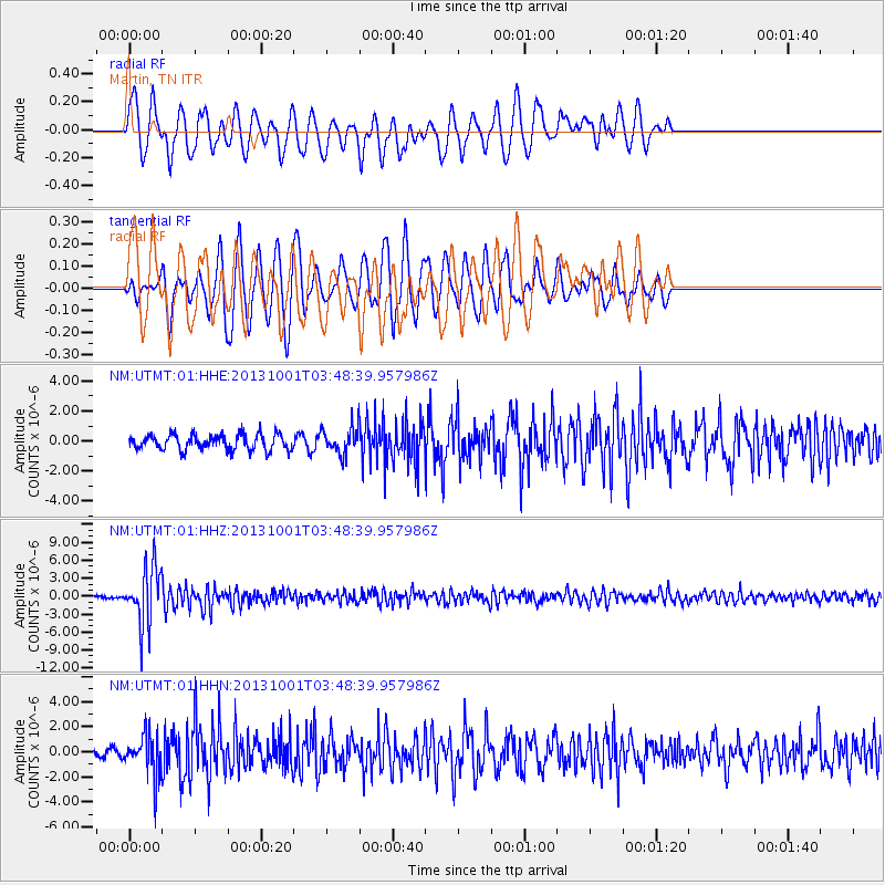
UTMT Martin, TN - Earthquake Result Viewer
*The percent match for this event was below the threshold and hence no stack was calculated.
| Earthquake location: |
Sea Of Okhotsk |
| Earthquake latitude/longitude: |
53.2/152.8 |
| Earthquake time(UTC): |
2013/10/01 (274) 03:38:21 GMT |
| Earthquake Depth: |
573 km |
| Earthquake Magnitude: |
6.7 MWW, 6.7 MWC, 6.8 MWC, 6.8 MWB |
| Earthquake Catalog/Contributor: |
NEIC PDE/NEIC COMCAT |
|
| Network: |
NM Cooperative New Madrid Seismic Network |
| Station: |
UTMT Martin, TN |
| Lat/Lon: |
36.35 N/88.86 W |
| Elevation: |
110 m |
|
| Distance: |
76.1 deg |
| Az: |
47.056 deg |
| Baz: |
326.941 deg |
| Ray Param: |
$rayparam |
*The percent match for this event was below the threshold and hence was not used in the summary stack. |
|
| Radial Match: |
63.171597 % |
| Radial Bump: |
400 |
| Transverse Match: |
60.28297 % |
| Transverse Bump: |
400 |
| SOD ConfigId: |
626651 |
| Insert Time: |
2014-04-18 23:08:28.985 +0000 |
| GWidth: |
2.5 |
| Max Bumps: |
400 |
| Tol: |
0.001 |
|
Signal To Noise
| Channel | StoN | STA | LTA |
| NM:UTMT:01:HHZ:20131001T03:48:39.957986Z | 20.931698 | 4.8281395E-6 | 2.3066163E-7 |
| NM:UTMT:01:HHN:20131001T03:48:39.957986Z | 3.5847816 | 1.621561E-6 | 4.5234583E-7 |
| NM:UTMT:01:HHE:20131001T03:48:39.957986Z | 1.6986544 | 8.757044E-7 | 5.155283E-7 |
| Arrivals |
| Ps | |
| PpPs | |
| PsPs/PpSs | |


