You are here: Home > Network List > IU - Global Seismograph Network (GSN - IRIS/USGS) Stations List
> Station CTAO Charters Towers, Australia > Earthquake Result Viewer
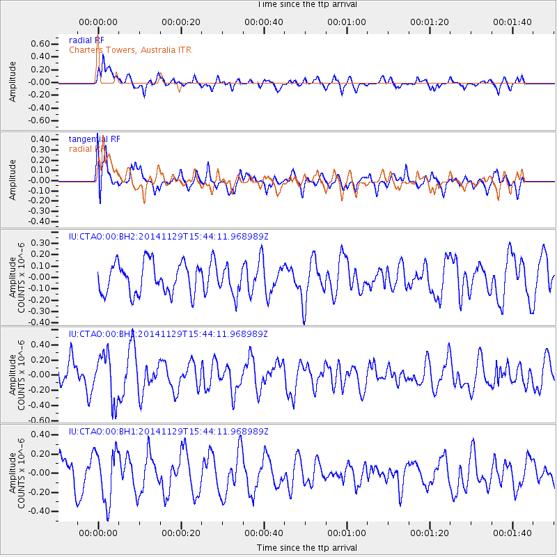
CTAO Charters Towers, Australia - Earthquake Result Viewer
*The percent match for this event was below the threshold and hence no stack was calculated.
| Earthquake location: |
Philippine Islands Region |
| Earthquake latitude/longitude: |
19.9/121.4 |
| Earthquake time(UTC): |
2014/11/29 (333) 15:36:17 GMT |
| Earthquake Depth: |
34 km |
| Earthquake Magnitude: |
5.3 MW, 4.6 MS, 5.2 mb |
| Earthquake Catalog/Contributor: |
ISC/ISC |
|
| Network: |
IU Global Seismograph Network (GSN - IRIS/USGS) |
| Station: |
CTAO Charters Towers, Australia |
| Lat/Lon: |
20.09 S/146.25 E |
| Elevation: |
357 m |
|
| Distance: |
46.6 deg |
| Az: |
147.102 deg |
| Baz: |
327.056 deg |
| Ray Param: |
$rayparam |
*The percent match for this event was below the threshold and hence was not used in the summary stack. |
|
| Radial Match: |
69.81251 % |
| Radial Bump: |
400 |
| Transverse Match: |
61.992504 % |
| Transverse Bump: |
400 |
| SOD ConfigId: |
3390531 |
| Insert Time: |
2019-04-15 06:06:23.514 +0000 |
| GWidth: |
2.5 |
| Max Bumps: |
400 |
| Tol: |
0.001 |
|
Signal To Noise
| Channel | StoN | STA | LTA |
| IU:CTAO:00:BHZ:20141129T15:44:11.968989Z | 1.3877326 | 3.106605E-7 | 2.2386193E-7 |
| IU:CTAO:00:BH1:20141129T15:44:11.968989Z | 1.9904398 | 2.7080864E-7 | 1.3605468E-7 |
| IU:CTAO:00:BH2:20141129T15:44:11.968989Z | 0.88422036 | 1.195152E-7 | 1.3516451E-7 |
| Arrivals |
| Ps | |
| PpPs | |
| PsPs/PpSs | |


