You are here: Home > Network List > TA - USArray Transportable Network (new EarthScope stations) Stations List
> Station C06D Leavenworth, WQ, USA > Earthquake Result Viewer
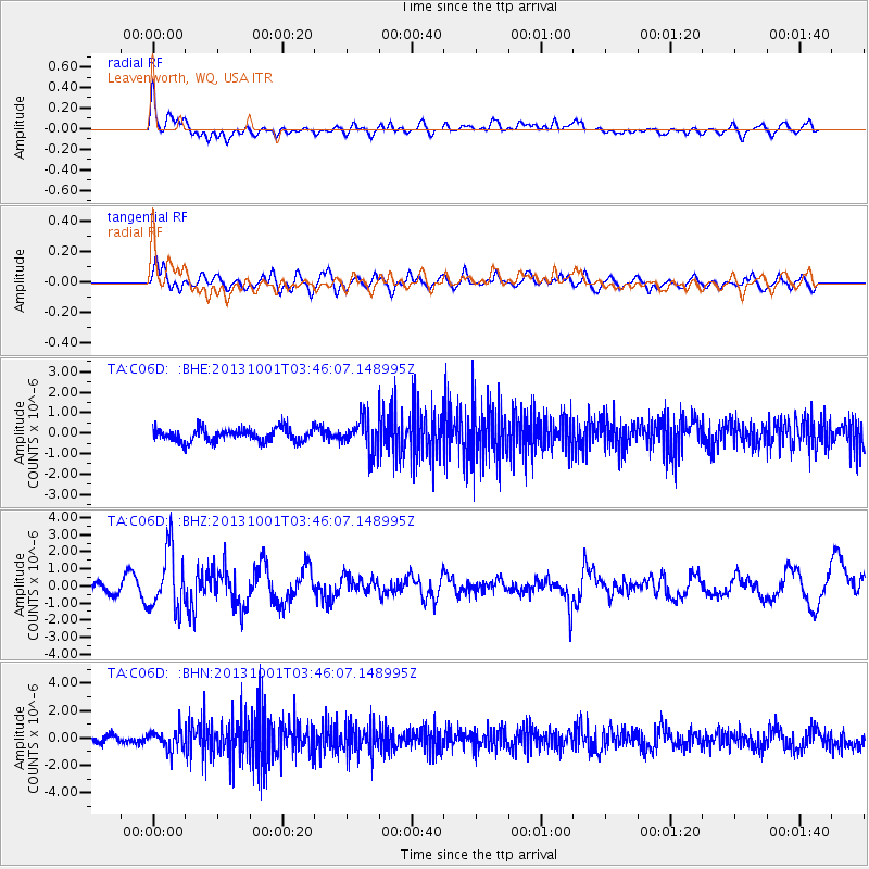
C06D Leavenworth, WQ, USA - Earthquake Result Viewer
*The percent match for this event was below the threshold and hence no stack was calculated.
| Earthquake location: |
Sea Of Okhotsk |
| Earthquake latitude/longitude: |
53.2/152.8 |
| Earthquake time(UTC): |
2013/10/01 (274) 03:38:21 GMT |
| Earthquake Depth: |
573 km |
| Earthquake Magnitude: |
6.7 MWW, 6.7 MWC, 6.8 MWC, 6.8 MWB |
| Earthquake Catalog/Contributor: |
NEIC PDE/NEIC COMCAT |
|
| Network: |
TA USArray Transportable Network (new EarthScope stations) |
| Station: |
C06D Leavenworth, WQ, USA |
| Lat/Lon: |
47.92 N/120.89 W |
| Elevation: |
544 m |
|
| Distance: |
51.9 deg |
| Az: |
58.539 deg |
| Baz: |
310.275 deg |
| Ray Param: |
$rayparam |
*The percent match for this event was below the threshold and hence was not used in the summary stack. |
|
| Radial Match: |
70.20121 % |
| Radial Bump: |
400 |
| Transverse Match: |
60.49279 % |
| Transverse Bump: |
400 |
| SOD ConfigId: |
626651 |
| Insert Time: |
2014-04-18 23:15:39.999 +0000 |
| GWidth: |
2.5 |
| Max Bumps: |
400 |
| Tol: |
0.001 |
|
Signal To Noise
| Channel | StoN | STA | LTA |
| TA:C06D: :BHZ:20131001T03:46:07.148995Z | 4.4597898 | 1.7901108E-6 | 4.0138906E-7 |
| TA:C06D: :BHN:20131001T03:46:07.148995Z | 2.718776 | 7.594754E-7 | 2.7934462E-7 |
| TA:C06D: :BHE:20131001T03:46:07.148995Z | 2.3932354 | 7.768105E-7 | 3.2458593E-7 |
| Arrivals |
| Ps | |
| PpPs | |
| PsPs/PpSs | |


