You are here: Home > Network List > TA - USArray Transportable Network (new EarthScope stations) Stations List
> Station D57A Chemin Vers le Barrage, Saint-Michel-Des-Saints, Q > Earthquake Result Viewer
D57A Chemin Vers le Barrage, Saint-Michel-Des-Saints, Q - Earthquake Result Viewer

| Earthquake location: |
Sea Of Okhotsk |
| Earthquake latitude/longitude: |
53.2/152.8 |
| Earthquake time(UTC): |
2013/10/01 (274) 03:38:21 GMT |
| Earthquake Depth: |
573 km |
| Earthquake Magnitude: |
6.7 MWW, 6.7 MWC, 6.8 MWC, 6.8 MWB |
| Earthquake Catalog/Contributor: |
NEIC PDE/NEIC COMCAT |
|
| Network: |
TA USArray Transportable Network (new EarthScope stations) |
| Station: |
D57A Chemin Vers le Barrage, Saint-Michel-Des-Saints, Q |
| Lat/Lon: |
47.02 N/73.89 W |
| Elevation: |
422 m |
|
| Distance: |
72.5 deg |
| Az: |
31.453 deg |
| Baz: |
332.691 deg |
| Ray Param: |
0.05169272 |
| Estimated Moho Depth: |
39.5 km |
| Estimated Crust Vp/Vs: |
1.75 |
| Assumed Crust Vp: |
6.61 km/s |
| Estimated Crust Vs: |
3.788 km/s |
| Estimated Crust Poisson's Ratio: |
0.26 |
|
| Radial Match: |
82.97998 % |
| Radial Bump: |
400 |
| Transverse Match: |
70.39568 % |
| Transverse Bump: |
400 |
| SOD ConfigId: |
626651 |
| Insert Time: |
2014-04-18 23:16:17.462 +0000 |
| GWidth: |
2.5 |
| Max Bumps: |
400 |
| Tol: |
0.001 |
|
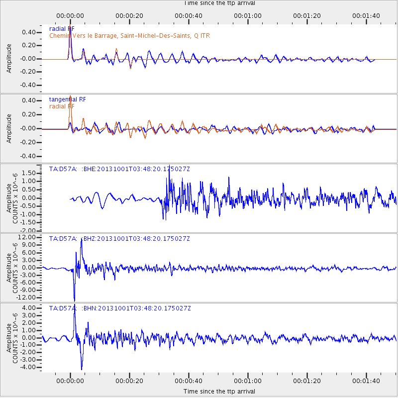
Signal To Noise
| Channel | StoN | STA | LTA |
| TA:D57A: :BHZ:20131001T03:48:20.175027Z | 13.42947 | 4.7755498E-6 | 3.5560222E-7 |
| TA:D57A: :BHN:20131001T03:48:20.175027Z | 6.335961 | 1.711849E-6 | 2.7017987E-7 |
| TA:D57A: :BHE:20131001T03:48:20.175027Z | 3.0890913 | 5.934351E-7 | 1.9210668E-7 |
| Arrivals |
| Ps | 4.6 SECOND |
| PpPs | 16 SECOND |
| PsPs/PpSs | 20 SECOND |


