You are here: Home > Network List > TA - USArray Transportable Network (new EarthScope stations) Stations List
> Station E55A Montcerf-Lytton, QC, CAN > Earthquake Result Viewer
E55A Montcerf-Lytton, QC, CAN - Earthquake Result Viewer

| Earthquake location: |
Sea Of Okhotsk |
| Earthquake latitude/longitude: |
53.2/152.8 |
| Earthquake time(UTC): |
2013/10/01 (274) 03:38:21 GMT |
| Earthquake Depth: |
573 km |
| Earthquake Magnitude: |
6.7 MWW, 6.7 MWC, 6.8 MWC, 6.8 MWB |
| Earthquake Catalog/Contributor: |
NEIC PDE/NEIC COMCAT |
|
| Network: |
TA USArray Transportable Network (new EarthScope stations) |
| Station: |
E55A Montcerf-Lytton, QC, CAN |
| Lat/Lon: |
46.45 N/76.06 W |
| Elevation: |
180 m |
|
| Distance: |
72.3 deg |
| Az: |
33.113 deg |
| Baz: |
331.617 deg |
| Ray Param: |
0.051818833 |
| Estimated Moho Depth: |
38.75 km |
| Estimated Crust Vp/Vs: |
1.79 |
| Assumed Crust Vp: |
6.622 km/s |
| Estimated Crust Vs: |
3.71 km/s |
| Estimated Crust Poisson's Ratio: |
0.27 |
|
| Radial Match: |
82.468376 % |
| Radial Bump: |
400 |
| Transverse Match: |
59.26769 % |
| Transverse Bump: |
400 |
| SOD ConfigId: |
626651 |
| Insert Time: |
2014-04-18 23:17:02.629 +0000 |
| GWidth: |
2.5 |
| Max Bumps: |
400 |
| Tol: |
0.001 |
|
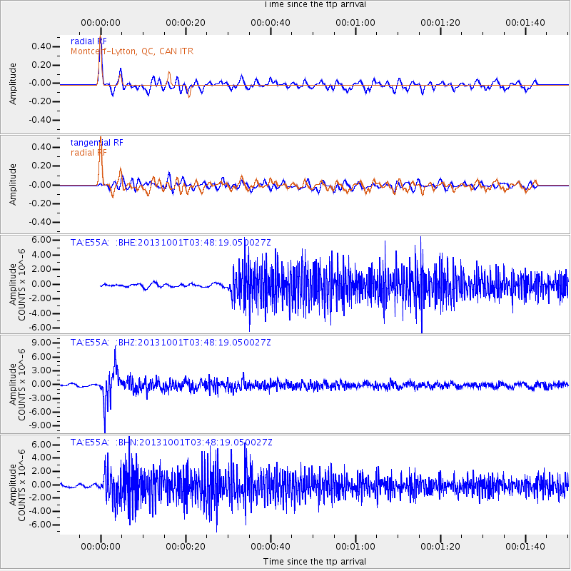
Signal To Noise
| Channel | StoN | STA | LTA |
| TA:E55A: :BHZ:20131001T03:48:19.050027Z | 13.745504 | 3.4376508E-6 | 2.5009274E-7 |
| TA:E55A: :BHN:20131001T03:48:19.050027Z | 9.4408045 | 2.1168069E-6 | 2.2421891E-7 |
| TA:E55A: :BHE:20131001T03:48:19.050027Z | 10.010161 | 2.0285854E-6 | 2.0265263E-7 |
| Arrivals |
| Ps | 4.8 SECOND |
| PpPs | 16 SECOND |
| PsPs/PpSs | 21 SECOND |


