You are here: Home > Network List > CI - Caltech Regional Seismic Network Stations List
> Station TIN Tinemaha, Big Pine, CA, USA > Earthquake Result Viewer
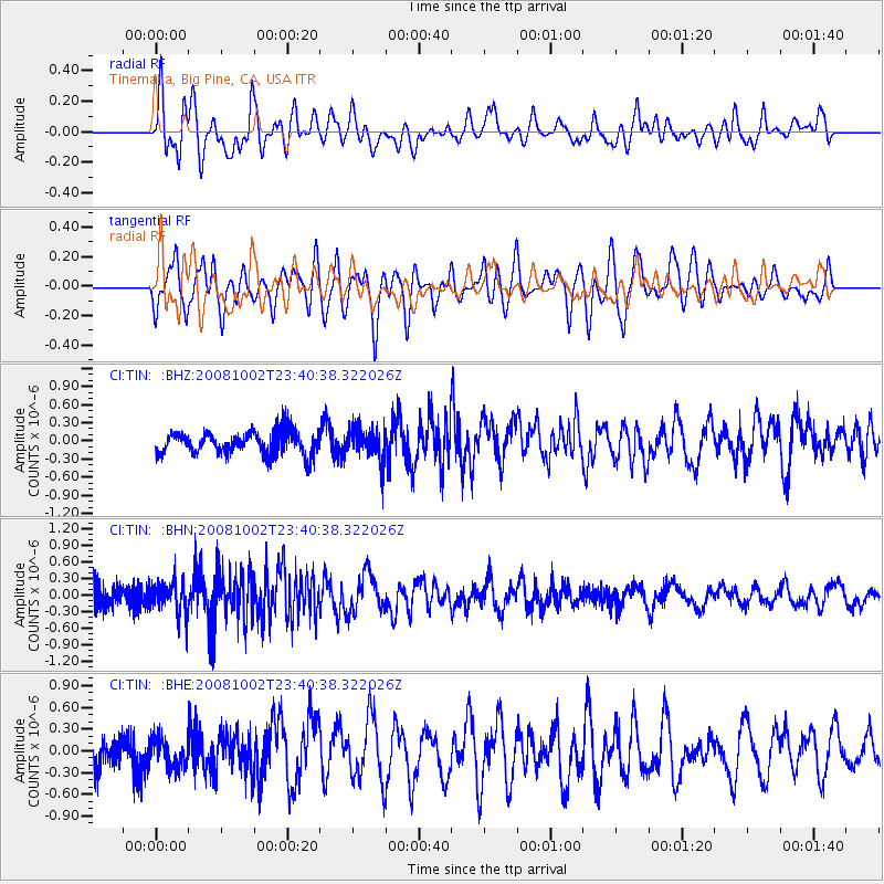
TIN Tinemaha, Big Pine, CA, USA - Earthquake Result Viewer
*The percent match for this event was below the threshold and hence no stack was calculated.
| Earthquake location: |
Southeast Of Loyalty Islands |
| Earthquake latitude/longitude: |
-23.0/169.9 |
| Earthquake time(UTC): |
2008/10/02 (276) 23:28:09 GMT |
| Earthquake Depth: |
10 km |
| Earthquake Magnitude: |
5.8 MB, 5.5 MS, 5.8 MW, 5.8 MW |
| Earthquake Catalog/Contributor: |
WHDF/NEIC |
|
| Network: |
CI Caltech Regional Seismic Network |
| Station: |
TIN Tinemaha, Big Pine, CA, USA |
| Lat/Lon: |
37.05 N/118.23 W |
| Elevation: |
1197 m |
|
| Distance: |
90.3 deg |
| Az: |
49.505 deg |
| Baz: |
241.137 deg |
| Ray Param: |
$rayparam |
*The percent match for this event was below the threshold and hence was not used in the summary stack. |
|
| Radial Match: |
61.041527 % |
| Radial Bump: |
400 |
| Transverse Match: |
56.032227 % |
| Transverse Bump: |
400 |
| SOD ConfigId: |
2556 |
| Insert Time: |
2010-02-25 20:52:34.019 +0000 |
| GWidth: |
2.5 |
| Max Bumps: |
400 |
| Tol: |
0.001 |
|
Signal To Noise
| Channel | StoN | STA | LTA |
| CI:TIN: :BHN:20081002T23:40:38.322026Z | 1.4115883 | 3.0673561E-7 | 2.1729822E-7 |
| CI:TIN: :BHE:20081002T23:40:38.322026Z | 0.77555877 | 1.931789E-7 | 2.490835E-7 |
| CI:TIN: :BHZ:20081002T23:40:38.322026Z | 1.4630007 | 2.7034443E-7 | 1.8478764E-7 |
| Arrivals |
| Ps | |
| PpPs | |
| PsPs/PpSs | |


