You are here: Home > Network List > II - Global Seismograph Network (GSN - IRIS/IDA) Stations List
> Station TAU Hobart, Tasmania, Australia > Earthquake Result Viewer
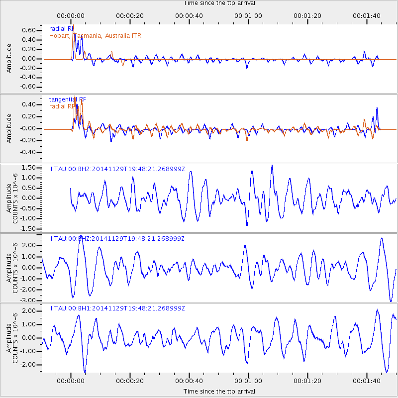
TAU Hobart, Tasmania, Australia - Earthquake Result Viewer
*The percent match for this event was below the threshold and hence no stack was calculated.
| Earthquake location: |
Northern Molucca Sea |
| Earthquake latitude/longitude: |
2.3/127.0 |
| Earthquake time(UTC): |
2014/11/29 (333) 19:40:09 GMT |
| Earthquake Depth: |
31 km |
| Earthquake Magnitude: |
5.6 MB |
| Earthquake Catalog/Contributor: |
NEIC PDE/NEIC COMCAT |
|
| Network: |
II Global Seismograph Network (GSN - IRIS/IDA) |
| Station: |
TAU Hobart, Tasmania, Australia |
| Lat/Lon: |
42.91 S/147.32 E |
| Elevation: |
132 m |
|
| Distance: |
48.6 deg |
| Az: |
160.086 deg |
| Baz: |
332.405 deg |
| Ray Param: |
$rayparam |
*The percent match for this event was below the threshold and hence was not used in the summary stack. |
|
| Radial Match: |
76.87838 % |
| Radial Bump: |
400 |
| Transverse Match: |
70.95775 % |
| Transverse Bump: |
400 |
| SOD ConfigId: |
3390531 |
| Insert Time: |
2019-04-15 06:11:55.767 +0000 |
| GWidth: |
2.5 |
| Max Bumps: |
400 |
| Tol: |
0.001 |
|
Signal To Noise
| Channel | StoN | STA | LTA |
| II:TAU:00:BHZ:20141129T19:48:21.268999Z | 3.612932 | 1.9067259E-6 | 5.277503E-7 |
| II:TAU:00:BH1:20141129T19:48:21.268999Z | 2.3163593 | 1.2091433E-6 | 5.220016E-7 |
| II:TAU:00:BH2:20141129T19:48:21.268999Z | 1.0435848 | 4.142749E-7 | 3.9697292E-7 |
| Arrivals |
| Ps | |
| PpPs | |
| PsPs/PpSs | |


