You are here: Home > Network List > II - Global Seismograph Network (GSN - IRIS/IDA) Stations List
> Station TLY Talaya, Russia > Earthquake Result Viewer
TLY Talaya, Russia - Earthquake Result Viewer
| Earthquake location: |
Southern Iran |
| Earthquake latitude/longitude: |
26.8/55.8 |
| Earthquake time(UTC): |
2005/11/27 (331) 16:30:37 GMT |
| Earthquake Depth: |
10 km |
| Earthquake Magnitude: |
5.4 MB, 5.3 MS, 5.5 MW |
| Earthquake Catalog/Contributor: |
WHDF/NEIC |
|
| Network: |
II Global Seismograph Network (GSN - IRIS/IDA) |
| Station: |
TLY Talaya, Russia |
| Lat/Lon: |
51.68 N/103.64 E |
| Elevation: |
579 m |
|
| Distance: |
43.5 deg |
| Az: |
42.06 deg |
| Baz: |
254.018 deg |
| Ray Param: |
0.07248442 |
| Estimated Moho Depth: |
10.0 km |
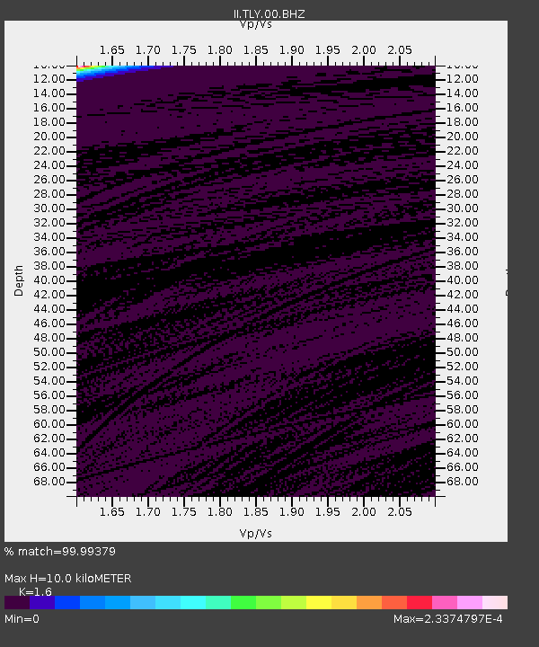
| Estimated Crust Vp/Vs: |
1.60 |
| Assumed Crust Vp: |
6.419 km/s |
| Estimated Crust Vs: |
4.012 km/s |
| Estimated Crust Poisson's Ratio: |
0.18 |
|
| Radial Match: |
99.99379 % |
| Radial Bump: |
2 |
| Transverse Match: |
99.99994 % |
| Transverse Bump: |
2 |
| SOD ConfigId: |
2669 |
| Insert Time: |
2010-03-01 17:05:31.659 +0000 |
| GWidth: |
2.5 |
| Max Bumps: |
400 |
| Tol: |
0.001 |
|
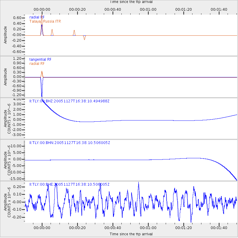
Signal To Noise
| Channel | StoN | STA | LTA |
| II:TLY:00:BHN:20051127T16:38:10.506005Z | 0.9084301 | 1.153499E-6 | 1.2697719E-6 |
| II:TLY:00:BHE:20051127T16:38:10.506005Z | 1.8664279 | 1.0624978E-7 | 5.6926805E-8 |
| II:TLY:00:BHZ:20051127T16:38:10.494988Z | 0.9116607 | 1.1686975E-6 | 1.2819435E-6 |
| Arrivals |
| Ps | 1.0 SECOND |
| PpPs | 3.8 SECOND |
| PsPs/PpSs | 4.8 SECOND |


