You are here: Home > Network List > US - United States National Seismic Network Stations List
> Station DGMT Dagmar, Montana, USA > Earthquake Result Viewer
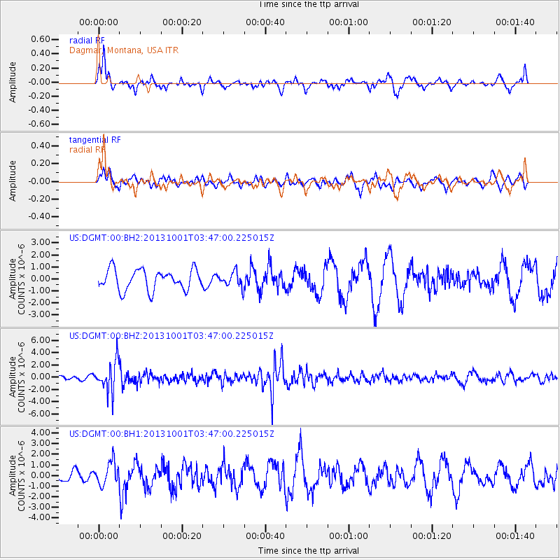
DGMT Dagmar, Montana, USA - Earthquake Result Viewer
*The percent match for this event was below the threshold and hence no stack was calculated.
| Earthquake location: |
Sea Of Okhotsk |
| Earthquake latitude/longitude: |
53.2/152.8 |
| Earthquake time(UTC): |
2013/10/01 (274) 03:38:21 GMT |
| Earthquake Depth: |
573 km |
| Earthquake Magnitude: |
6.7 MWW, 6.7 MWC, 6.8 MWC, 6.8 MWB |
| Earthquake Catalog/Contributor: |
NEIC PDE/NEIC COMCAT |
|
| Network: |
US United States National Seismic Network |
| Station: |
DGMT Dagmar, Montana, USA |
| Lat/Lon: |
48.47 N/104.20 W |
| Elevation: |
0.0 m |
|
| Distance: |
59.6 deg |
| Az: |
48.742 deg |
| Baz: |
317.19 deg |
| Ray Param: |
$rayparam |
*The percent match for this event was below the threshold and hence was not used in the summary stack. |
|
| Radial Match: |
47.145878 % |
| Radial Bump: |
348 |
| Transverse Match: |
36.84716 % |
| Transverse Bump: |
369 |
| SOD ConfigId: |
626651 |
| Insert Time: |
2014-04-18 23:34:51.649 +0000 |
| GWidth: |
2.5 |
| Max Bumps: |
400 |
| Tol: |
0.001 |
|
Signal To Noise
| Channel | StoN | STA | LTA |
| US:DGMT:00:BHZ:20131001T03:47:00.225015Z | 10.6432085 | 2.422001E-6 | 2.2756306E-7 |
| US:DGMT:00:BH1:20131001T03:47:00.225015Z | 1.6897866 | 1.1174634E-6 | 6.613045E-7 |
| US:DGMT:00:BH2:20131001T03:47:00.225015Z | 0.7505752 | 6.397528E-7 | 8.5234996E-7 |
| Arrivals |
| Ps | |
| PpPs | |
| PsPs/PpSs | |


