You are here: Home > Network List > UW - Pacific Northwest Regional Seismic Network Stations List
> Station MRBL Marblemount, WA, USA > Earthquake Result Viewer
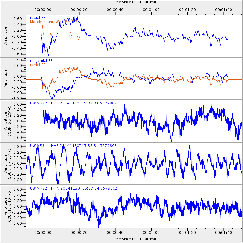
MRBL Marblemount, WA, USA - Earthquake Result Viewer
*The percent match for this event was below the threshold and hence no stack was calculated.
| Earthquake location: |
W. Caroline Islands, Micronesia |
| Earthquake latitude/longitude: |
6.1/133.5 |
| Earthquake time(UTC): |
2014/11/30 (334) 15:24:45 GMT |
| Earthquake Depth: |
35 km |
| Earthquake Magnitude: |
4.9 MW, 3.8 MS, 4.9 mb |
| Earthquake Catalog/Contributor: |
ISC/ISC |
|
| Network: |
UW Pacific Northwest Regional Seismic Network |
| Station: |
MRBL Marblemount, WA, USA |
| Lat/Lon: |
48.52 N/121.48 W |
| Elevation: |
75 m |
|
| Distance: |
95.3 deg |
| Az: |
40.169 deg |
| Baz: |
285.242 deg |
| Ray Param: |
$rayparam |
*The percent match for this event was below the threshold and hence was not used in the summary stack. |
|
| Radial Match: |
48.360542 % |
| Radial Bump: |
400 |
| Transverse Match: |
48.365913 % |
| Transverse Bump: |
400 |
| SOD ConfigId: |
3390531 |
| Insert Time: |
2019-04-15 06:24:16.197 +0000 |
| GWidth: |
2.5 |
| Max Bumps: |
400 |
| Tol: |
0.001 |
|
Signal To Noise
| Channel | StoN | STA | LTA |
| UW:MRBL: :HHZ:20141130T15:37:34.557986Z | 1.0273714 | 1.3380306E-7 | 1.3023826E-7 |
| UW:MRBL: :HHN:20141130T15:37:34.557986Z | 2.026168 | 3.8506147E-7 | 1.900442E-7 |
| UW:MRBL: :HHE:20141130T15:37:34.557986Z | 1.367793 | 2.0581886E-7 | 1.5047516E-7 |
| Arrivals |
| Ps | |
| PpPs | |
| PsPs/PpSs | |


