You are here: Home > Network List > II - Global Seismograph Network (GSN - IRIS/IDA) Stations List
> Station WRAB Tennant Creek, NT, Australia > Earthquake Result Viewer
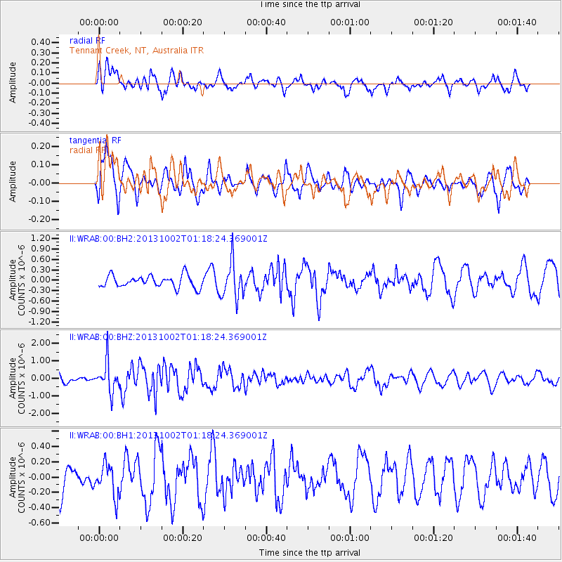
WRAB Tennant Creek, NT, Australia - Earthquake Result Viewer
*The percent match for this event was below the threshold and hence no stack was calculated.
| Earthquake location: |
Owen Fracture Zone Region |
| Earthquake latitude/longitude: |
11.2/57.6 |
| Earthquake time(UTC): |
2013/10/02 (275) 01:06:37 GMT |
| Earthquake Depth: |
7.9 km |
| Earthquake Magnitude: |
5.7 MWW, 5.6 MWB, 5.7 MWW, 5.8 MWC |
| Earthquake Catalog/Contributor: |
NEIC PDE/NEIC COMCAT |
|
| Network: |
II Global Seismograph Network (GSN - IRIS/IDA) |
| Station: |
WRAB Tennant Creek, NT, Australia |
| Lat/Lon: |
19.93 S/134.36 E |
| Elevation: |
366 m |
|
| Distance: |
81.6 deg |
| Az: |
112.222 deg |
| Baz: |
285.123 deg |
| Ray Param: |
$rayparam |
*The percent match for this event was below the threshold and hence was not used in the summary stack. |
|
| Radial Match: |
56.907257 % |
| Radial Bump: |
400 |
| Transverse Match: |
68.93353 % |
| Transverse Bump: |
400 |
| SOD ConfigId: |
626651 |
| Insert Time: |
2014-04-18 23:46:00.517 +0000 |
| GWidth: |
2.5 |
| Max Bumps: |
400 |
| Tol: |
0.001 |
|
Signal To Noise
| Channel | StoN | STA | LTA |
| II:WRAB:00:BHZ:20131002T01:18:24.369001Z | 3.6592357 | 8.668888E-7 | 2.3690434E-7 |
| II:WRAB:00:BH1:20131002T01:18:24.369001Z | 0.8981369 | 2.1414472E-7 | 2.3843216E-7 |
| II:WRAB:00:BH2:20131002T01:18:24.369001Z | 3.0589783 | 5.2340056E-7 | 1.7110307E-7 |
| Arrivals |
| Ps | |
| PpPs | |
| PsPs/PpSs | |


