GNI Garni, Armenia - Earthquake Result Viewer
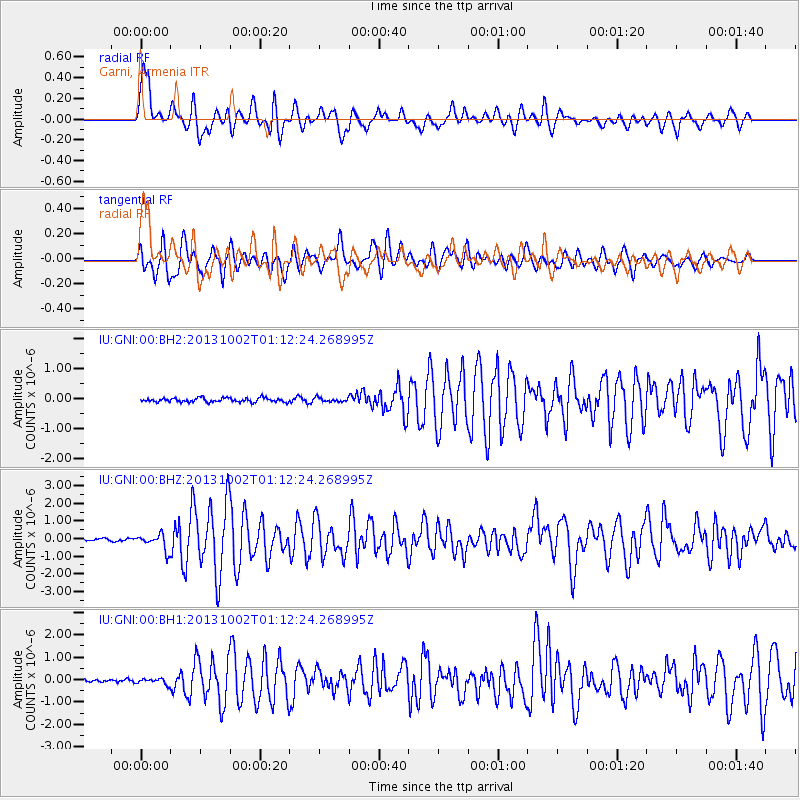
Earthquake location: Owen Fracture Zone Region
Earthquake latitude/longitude: 11.2/57.6
Earthquake time(UTC): 2013/10/02 (275) 01:06:37 GMT
Earthquake Depth: 7.9 km
Earthquake Magnitude: 5.7 MWW, 5.6 MWB, 5.7 MWW, 5.8 MWC
Earthquake Catalog/Contributor: NEIC PDE/NEIC COMCAT
Network: IU Global Seismograph Network (GSN - IRIS/USGS)
Station: GNI Garni, Armenia
Lat/Lon: 40.15 N/44.74 E
Elevation: 1609 m
Distance: 31.0 deg
Az: 340.655 deg
Baz: 154.912 deg
Ray Param: 0.07919501
Estimated Moho Depth: 62.25 km
Estimated Crust Vp/Vs: 1.83
Assumed Crust Vp: 6.291 km/s
Estimated Crust Vs: 3.438 km/s
Estimated Crust Poisson's Ratio: 0.29
Radial Match: 86.414665 %
Radial Bump: 400
Transverse Match: 75.507744 %
Transverse Bump: 400
SOD ConfigId: 626651
Insert Time: 2014-04-18 23:46:51.986 +0000
GWidth: 2.5
Max Bumps: 400
Tol: 0.001

Signal To Noise

ChannelStoNSTALTA
IU:GNI:00:BHZ:20131002T01:12:24.268995Z6.2098044.6101763E-77.424029E-8
IU:GNI:00:BH1:20131002T01:12:24.268995Z1.82627321.2766141E-76.990268E-8
IU:GNI:00:BH2:20131002T01:12:24.268995Z0.98763556.731611E-86.815886E-8
Arrivals
Ps8.8 SECOND
PpPs26 SECOND
PsPs/PpSs35 SECOND