You are here: Home > Network List > BK - Berkeley Digital Seismograph Network Stations List
> Station HUMO Hull Mountain, OR > Earthquake Result Viewer
HUMO Hull Mountain, OR - Earthquake Result Viewer
*The percent match for this event was below the threshold and hence no stack was calculated.
| Earthquake location: |
South Of Mariana Islands |
| Earthquake latitude/longitude: |
12.3/141.7 |
| Earthquake time(UTC): |
2013/10/06 (279) 16:38:08 GMT |
| Earthquake Depth: |
104 km |
| Earthquake Magnitude: |
6.0 MWW, 6.0 MWB, 6.0 MWW, 6.1 MWC |
| Earthquake Catalog/Contributor: |
NEIC PDE/NEIC COMCAT |
|
| Network: |
BK Berkeley Digital Seismograph Network |
| Station: |
HUMO Hull Mountain, OR |
| Lat/Lon: |
42.61 N/122.96 W |
| Elevation: |
555 m |
|
| Distance: |
85.7 deg |
| Az: |
47.49 deg |
| Baz: |
282.623 deg |
| Ray Param: |
$rayparam |
*The percent match for this event was below the threshold and hence was not used in the summary stack. |
|
| Radial Match: |
78.07041 % |
| Radial Bump: |
400 |
| Transverse Match: |
43.045963 % |
| Transverse Bump: |
320 |
| SOD ConfigId: |
626651 |
| Insert Time: |
2014-04-19 00:04:44.528 +0000 |
| GWidth: |
2.5 |
| Max Bumps: |
400 |
| Tol: |
0.001 |
|
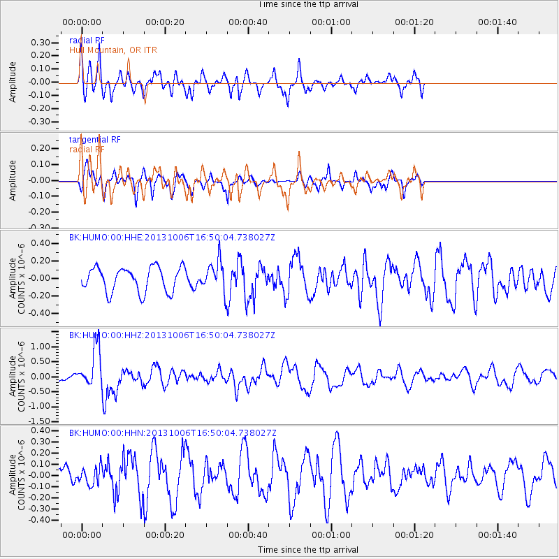
Signal To Noise
| Channel | StoN | STA | LTA |
| BK:HUMO:00:HHZ:20131006T16:50:04.738027Z | 5.9054923 | 6.81423E-7 | 1.1538801E-7 |
| BK:HUMO:00:HHN:20131006T16:50:04.738027Z | 0.5394565 | 7.9088515E-8 | 1.4660776E-7 |
| BK:HUMO:00:HHE:20131006T16:50:04.738027Z | 1.2800454 | 1.7931004E-7 | 1.40081E-7 |
| Arrivals |
| Ps | |
| PpPs | |
| PsPs/PpSs | |


