You are here: Home > Network List > GO - National Seismic Network of Georgia Stations List
> Station TBLG Delisi, Georgia > Earthquake Result Viewer
TBLG Delisi, Georgia - Earthquake Result Viewer
*The percent match for this event was below the threshold and hence no stack was calculated.
| Earthquake location: |
South Of Mariana Islands |
| Earthquake latitude/longitude: |
12.3/141.7 |
| Earthquake time(UTC): |
2013/10/06 (279) 16:38:08 GMT |
| Earthquake Depth: |
104 km |
| Earthquake Magnitude: |
6.0 MWW, 6.0 MWB, 6.0 MWW, 6.1 MWC |
| Earthquake Catalog/Contributor: |
NEIC PDE/NEIC COMCAT |
|
| Network: |
GO National Seismic Network of Georgia |
| Station: |
TBLG Delisi, Georgia |
| Lat/Lon: |
41.73 N/44.74 E |
| Elevation: |
510 m |
|
| Distance: |
87.0 deg |
| Az: |
311.927 deg |
| Baz: |
76.27 deg |
| Ray Param: |
$rayparam |
*The percent match for this event was below the threshold and hence was not used in the summary stack. |
|
| Radial Match: |
53.604843 % |
| Radial Bump: |
400 |
| Transverse Match: |
49.168602 % |
| Transverse Bump: |
400 |
| SOD ConfigId: |
626651 |
| Insert Time: |
2014-04-19 00:09:18.680 +0000 |
| GWidth: |
2.5 |
| Max Bumps: |
400 |
| Tol: |
0.001 |
|
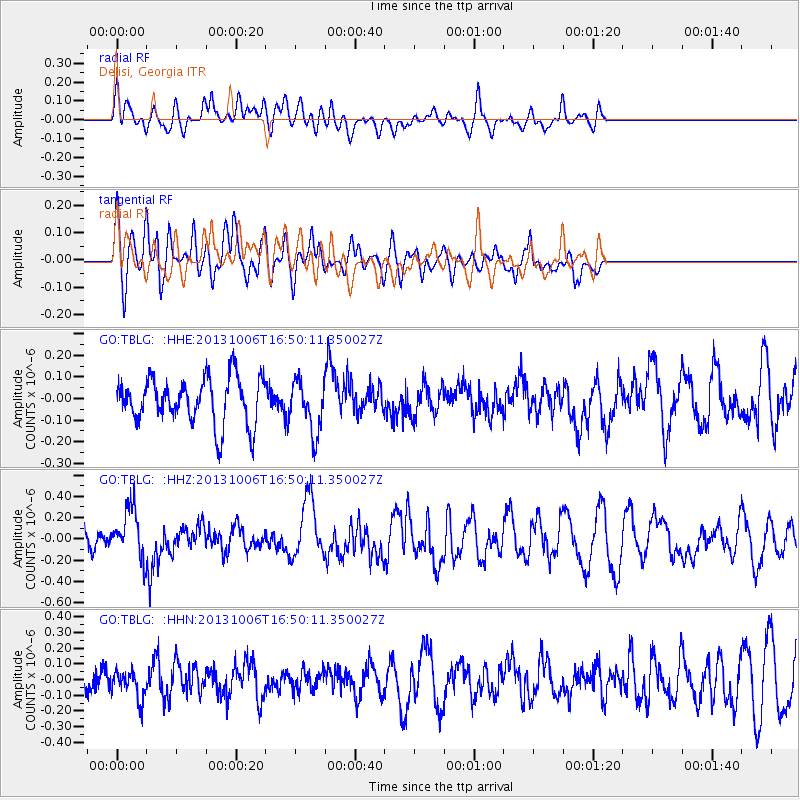
Signal To Noise
| Channel | StoN | STA | LTA |
| GO:TBLG: :HHZ:20131006T16:50:11.350027Z | 2.0808918 | 2.3161634E-7 | 1.1130629E-7 |
| GO:TBLG: :HHN:20131006T16:50:11.350027Z | 1.1046034 | 8.9707584E-8 | 8.1212484E-8 |
| GO:TBLG: :HHE:20131006T16:50:11.350027Z | 1.1323655 | 1.2023358E-7 | 1.0617913E-7 |
| Arrivals |
| Ps | |
| PpPs | |
| PsPs/PpSs | |


