You are here: Home > Network List > TA - USArray Transportable Network (new EarthScope stations) Stations List
> Station N02D Trinity Center, CA, USA > Earthquake Result Viewer
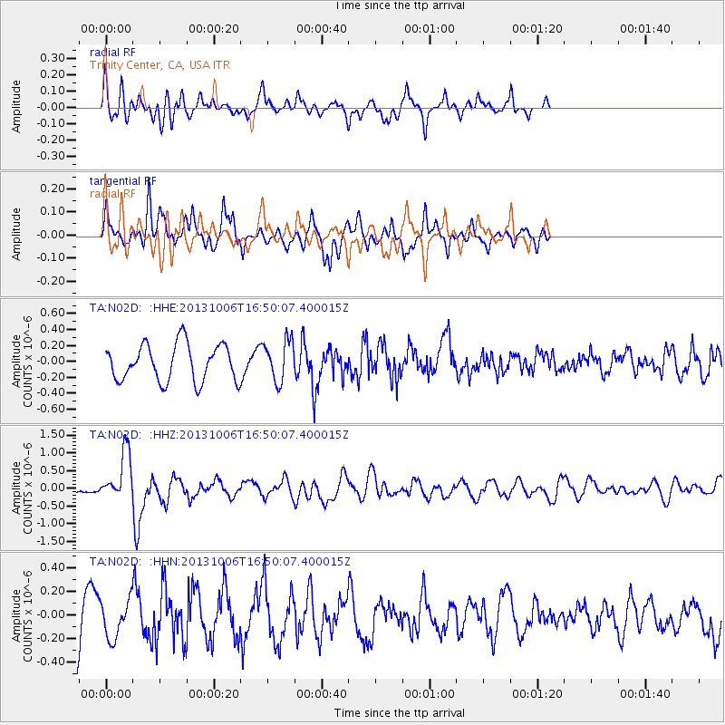
N02D Trinity Center, CA, USA - Earthquake Result Viewer
*The percent match for this event was below the threshold and hence no stack was calculated.
| Earthquake location: |
South Of Mariana Islands |
| Earthquake latitude/longitude: |
12.3/141.7 |
| Earthquake time(UTC): |
2013/10/06 (279) 16:38:08 GMT |
| Earthquake Depth: |
104 km |
| Earthquake Magnitude: |
6.0 MWW, 6.0 MWB, 6.0 MWW, 6.1 MWC |
| Earthquake Catalog/Contributor: |
NEIC PDE/NEIC COMCAT |
|
| Network: |
TA USArray Transportable Network (new EarthScope stations) |
| Station: |
N02D Trinity Center, CA, USA |
| Lat/Lon: |
40.97 N/122.71 W |
| Elevation: |
937 m |
|
| Distance: |
86.2 deg |
| Az: |
49.044 deg |
| Baz: |
282.9 deg |
| Ray Param: |
$rayparam |
*The percent match for this event was below the threshold and hence was not used in the summary stack. |
|
| Radial Match: |
66.43678 % |
| Radial Bump: |
400 |
| Transverse Match: |
42.82419 % |
| Transverse Bump: |
396 |
| SOD ConfigId: |
626651 |
| Insert Time: |
2014-04-19 00:18:20.341 +0000 |
| GWidth: |
2.5 |
| Max Bumps: |
400 |
| Tol: |
0.001 |
|
Signal To Noise
| Channel | StoN | STA | LTA |
| TA:N02D: :HHZ:20131006T16:50:07.400015Z | 3.2037144 | 6.903801E-7 | 2.1549364E-7 |
| TA:N02D: :HHN:20131006T16:50:07.400015Z | 0.5638082 | 1.5370233E-7 | 2.7261456E-7 |
| TA:N02D: :HHE:20131006T16:50:07.400015Z | 1.131454 | 2.6034888E-7 | 2.3010118E-7 |
| Arrivals |
| Ps | |
| PpPs | |
| PsPs/PpSs | |


