You are here: Home > Network List > US - United States National Seismic Network Stations List
> Station MSO Missoula, Montana, USA > Earthquake Result Viewer
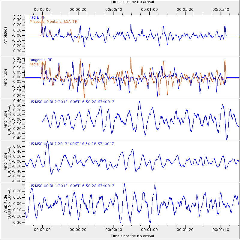
MSO Missoula, Montana, USA - Earthquake Result Viewer
*The percent match for this event was below the threshold and hence no stack was calculated.
| Earthquake location: |
South Of Mariana Islands |
| Earthquake latitude/longitude: |
12.3/141.7 |
| Earthquake time(UTC): |
2013/10/06 (279) 16:38:08 GMT |
| Earthquake Depth: |
104 km |
| Earthquake Magnitude: |
6.0 MWW, 6.0 MWB, 6.0 MWW, 6.1 MWC |
| Earthquake Catalog/Contributor: |
NEIC PDE/NEIC COMCAT |
|
| Network: |
US United States National Seismic Network |
| Station: |
MSO Missoula, Montana, USA |
| Lat/Lon: |
46.83 N/113.94 W |
| Elevation: |
1264 m |
|
| Distance: |
90.7 deg |
| Az: |
41.697 deg |
| Baz: |
288.773 deg |
| Ray Param: |
$rayparam |
*The percent match for this event was below the threshold and hence was not used in the summary stack. |
|
| Radial Match: |
53.93289 % |
| Radial Bump: |
383 |
| Transverse Match: |
66.37611 % |
| Transverse Bump: |
364 |
| SOD ConfigId: |
626651 |
| Insert Time: |
2014-04-19 00:19:50.680 +0000 |
| GWidth: |
2.5 |
| Max Bumps: |
400 |
| Tol: |
0.001 |
|
Signal To Noise
| Channel | StoN | STA | LTA |
| US:MSO:00:BHZ:20131006T16:50:28.674001Z | 2.1094265 | 4.1465267E-7 | 1.9657129E-7 |
| US:MSO:00:BH1:20131006T16:50:28.674001Z | 0.40801093 | 6.372445E-8 | 1.5618319E-7 |
| US:MSO:00:BH2:20131006T16:50:28.674001Z | 1.6178585 | 1.7687081E-7 | 1.0932403E-7 |
| Arrivals |
| Ps | |
| PpPs | |
| PsPs/PpSs | |


