You are here: Home > Network List > UU - University of Utah Regional Network Stations List
> Station KNB Kanab, UT, USA > Earthquake Result Viewer
KNB Kanab, UT, USA - Earthquake Result Viewer
*The percent match for this event was below the threshold and hence no stack was calculated.
| Earthquake location: |
South Of Mariana Islands |
| Earthquake latitude/longitude: |
12.3/141.7 |
| Earthquake time(UTC): |
2013/10/06 (279) 16:38:08 GMT |
| Earthquake Depth: |
104 km |
| Earthquake Magnitude: |
6.0 MWW, 6.0 MWB, 6.0 MWW, 6.1 MWC |
| Earthquake Catalog/Contributor: |
NEIC PDE/NEIC COMCAT |
|
| Network: |
UU University of Utah Regional Network |
| Station: |
KNB Kanab, UT, USA |
| Lat/Lon: |
37.02 N/112.82 W |
| Elevation: |
1715 m |
|
| Distance: |
94.7 deg |
| Az: |
50.708 deg |
| Baz: |
289.094 deg |
| Ray Param: |
$rayparam |
*The percent match for this event was below the threshold and hence was not used in the summary stack. |
|
| Radial Match: |
68.64544 % |
| Radial Bump: |
400 |
| Transverse Match: |
55.27743 % |
| Transverse Bump: |
382 |
| SOD ConfigId: |
626651 |
| Insert Time: |
2014-04-19 00:20:33.264 +0000 |
| GWidth: |
2.5 |
| Max Bumps: |
400 |
| Tol: |
0.001 |
|
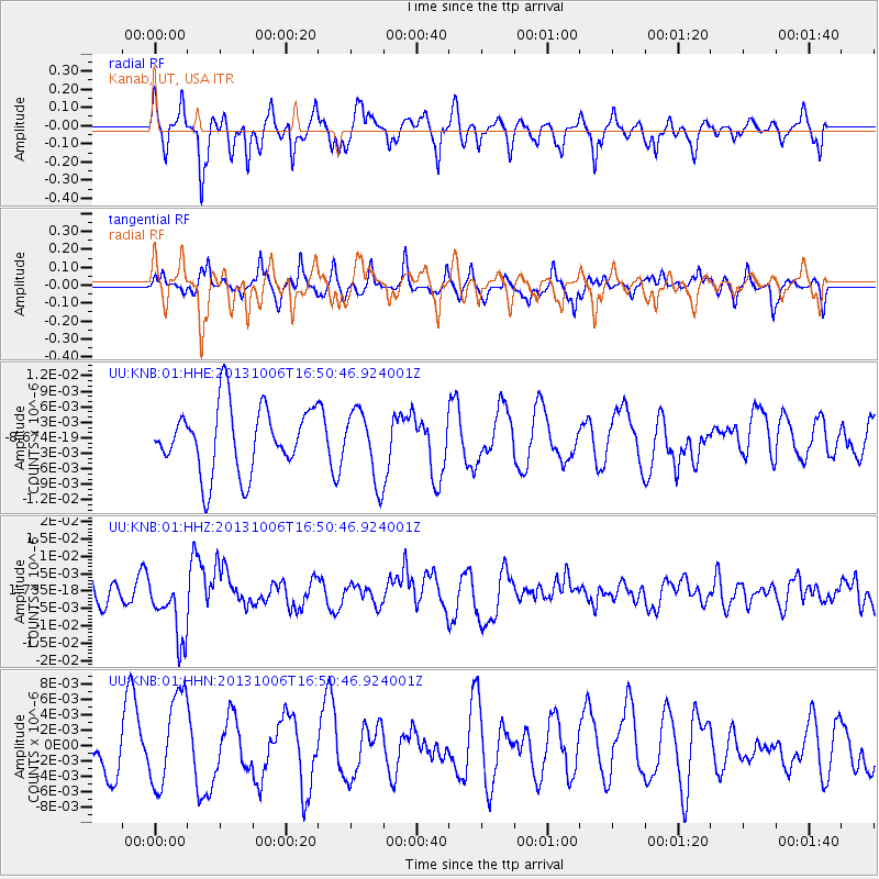
Signal To Noise
| Channel | StoN | STA | LTA |
| UU:KNB:01:HHZ:20131006T16:50:46.924001Z | 2.1276653 | 9.435443E-9 | 4.434646E-9 |
| UU:KNB:01:HHN:20131006T16:50:46.924001Z | 1.8078411 | 6.007932E-9 | 3.3232634E-9 |
| UU:KNB:01:HHE:20131006T16:50:46.924001Z | 1.0616602 | 6.7398904E-9 | 6.3484444E-9 |
| Arrivals |
| Ps | |
| PpPs | |
| PsPs/PpSs | |


