You are here: Home > Network List > G - GEOSCOPE Stations List
> Station NOUC Port Laguerre, New Caledonia > Earthquake Result Viewer
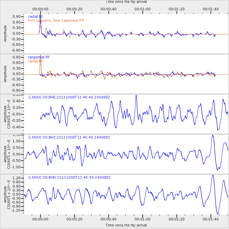
NOUC Port Laguerre, New Caledonia - Earthquake Result Viewer
*The percent match for this event was below the threshold and hence no stack was calculated.
| Earthquake location: |
West Of Macquarie Island |
| Earthquake latitude/longitude: |
-58.9/149.0 |
| Earthquake time(UTC): |
2013/10/08 (281) 13:39:55 GMT |
| Earthquake Depth: |
10 km |
| Earthquake Magnitude: |
5.7 MWW, 5.7 MWB, 5.7 MWW, 5.8 MWC |
| Earthquake Catalog/Contributor: |
NEIC PDE/NEIC COMCAT |
|
| Network: |
G GEOSCOPE |
| Station: |
NOUC Port Laguerre, New Caledonia |
| Lat/Lon: |
22.10 S/166.30 E |
| Elevation: |
112 m |
|
| Distance: |
38.8 deg |
| Az: |
26.065 deg |
| Baz: |
194.243 deg |
| Ray Param: |
$rayparam |
*The percent match for this event was below the threshold and hence was not used in the summary stack. |
|
| Radial Match: |
73.046074 % |
| Radial Bump: |
361 |
| Transverse Match: |
48.7505 % |
| Transverse Bump: |
400 |
| SOD ConfigId: |
626651 |
| Insert Time: |
2014-04-19 00:51:53.569 +0000 |
| GWidth: |
2.5 |
| Max Bumps: |
400 |
| Tol: |
0.001 |
|
Signal To Noise
| Channel | StoN | STA | LTA |
| G:NOUC:00:BHZ:20131008T13:46:49.349988Z | 1.8299946 | 4.0553073E-7 | 2.2160215E-7 |
| G:NOUC:00:BHN:20131008T13:46:49.349988Z | 2.0810666 | 3.8272924E-7 | 1.8391013E-7 |
| G:NOUC:00:BHE:20131008T13:46:49.349988Z | 1.2678244 | 1.6922566E-7 | 1.334772E-7 |
| Arrivals |
| Ps | |
| PpPs | |
| PsPs/PpSs | |


