You are here: Home > Network List > GT - Global Telemetered Seismograph Network (USAF/USGS) Stations List
> Station PLCA Paso Flores, Argentina > Earthquake Result Viewer
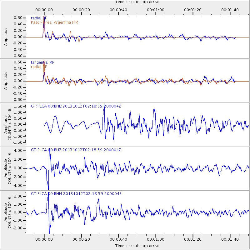
PLCA Paso Flores, Argentina - Earthquake Result Viewer
*The percent match for this event was below the threshold and hence no stack was calculated.
| Earthquake location: |
Near Coast Of Venezuela |
| Earthquake latitude/longitude: |
10.9/-62.3 |
| Earthquake time(UTC): |
2013/10/12 (285) 02:10:27 GMT |
| Earthquake Depth: |
63 km |
| Earthquake Magnitude: |
6.0 MWW, 6.0 MWW, 6.0 MWB, 6.0 MWC, 6.0 MI |
| Earthquake Catalog/Contributor: |
NEIC PDE/NEIC COMCAT |
|
| Network: |
GT Global Telemetered Seismograph Network (USAF/USGS) |
| Station: |
PLCA Paso Flores, Argentina |
| Lat/Lon: |
40.73 S/70.55 W |
| Elevation: |
1050 m |
|
| Distance: |
51.9 deg |
| Az: |
187.947 deg |
| Baz: |
10.294 deg |
| Ray Param: |
$rayparam |
*The percent match for this event was below the threshold and hence was not used in the summary stack. |
|
| Radial Match: |
65.36562 % |
| Radial Bump: |
318 |
| Transverse Match: |
66.63191 % |
| Transverse Bump: |
379 |
| SOD ConfigId: |
626651 |
| Insert Time: |
2014-04-19 01:28:04.713 +0000 |
| GWidth: |
2.5 |
| Max Bumps: |
400 |
| Tol: |
0.001 |
|
Signal To Noise
| Channel | StoN | STA | LTA |
| GT:PLCA:00:BHZ:20131012T02:18:59.200004Z | 7.4686084 | 2.1129345E-6 | 2.8290873E-7 |
| GT:PLCA:00:BHN:20131012T02:18:59.200004Z | 3.2110207 | 1.1889626E-6 | 3.7027561E-7 |
| GT:PLCA:00:BHE:20131012T02:18:59.200004Z | 2.1316743 | 6.698756E-7 | 3.1424855E-7 |
| Arrivals |
| Ps | |
| PpPs | |
| PsPs/PpSs | |


