You are here: Home > Network List > IW - Intermountain West Stations List
> Station PLID Pearl Lake, Idaho, USA > Earthquake Result Viewer
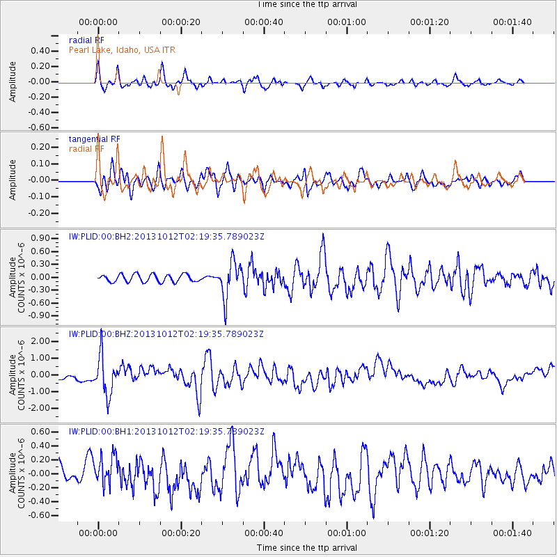
PLID Pearl Lake, Idaho, USA - Earthquake Result Viewer
*The percent match for this event was below the threshold and hence no stack was calculated.
| Earthquake location: |
Near Coast Of Venezuela |
| Earthquake latitude/longitude: |
10.9/-62.3 |
| Earthquake time(UTC): |
2013/10/12 (285) 02:10:27 GMT |
| Earthquake Depth: |
63 km |
| Earthquake Magnitude: |
6.0 MWW, 6.0 MWW, 6.0 MWB, 6.0 MWC, 6.0 MI |
| Earthquake Catalog/Contributor: |
NEIC PDE/NEIC COMCAT |
|
| Network: |
IW Intermountain West |
| Station: |
PLID Pearl Lake, Idaho, USA |
| Lat/Lon: |
45.09 N/116.00 W |
| Elevation: |
2164 m |
|
| Distance: |
57.0 deg |
| Az: |
317.105 deg |
| Baz: |
109.316 deg |
| Ray Param: |
$rayparam |
*The percent match for this event was below the threshold and hence was not used in the summary stack. |
|
| Radial Match: |
79.615944 % |
| Radial Bump: |
400 |
| Transverse Match: |
71.4933 % |
| Transverse Bump: |
400 |
| SOD ConfigId: |
626651 |
| Insert Time: |
2014-04-19 01:30:40.921 +0000 |
| GWidth: |
2.5 |
| Max Bumps: |
400 |
| Tol: |
0.001 |
|
Signal To Noise
| Channel | StoN | STA | LTA |
| IW:PLID:00:BHZ:20131012T02:19:35.789023Z | 6.2789474 | 1.1782738E-6 | 1.8765466E-7 |
| IW:PLID:00:BH1:20131012T02:19:35.789023Z | 2.1718845 | 2.1190458E-7 | 9.7567145E-8 |
| IW:PLID:00:BH2:20131012T02:19:35.789023Z | 4.9834414 | 4.349321E-7 | 8.727545E-8 |
| Arrivals |
| Ps | |
| PpPs | |
| PsPs/PpSs | |


