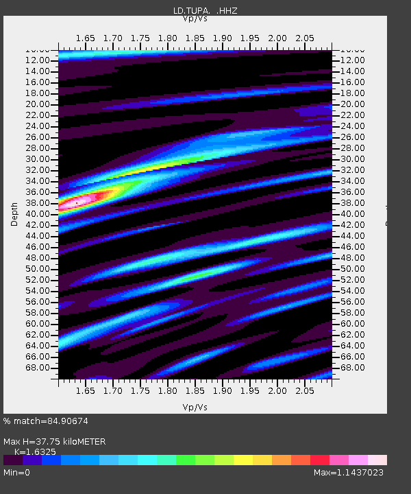
TUPA Temple University, Pennsylvania - Earthquake Result Viewer

Earthquake location: Near Coast Of Venezuela
Earthquake latitude/longitude: 10.9/-62.3
Earthquake time(UTC): 2013/10/12 (285) 02:10:27 GMT
Earthquake Depth: 63 km
Earthquake Magnitude: 6.0 MWW, 6.0 MWW, 6.0 MWB, 6.0 MWC, 6.0 MI
Earthquake Catalog/Contributor: NEIC PDE/NEIC COMCAT
Network: LD Lamont-Doherty Cooperative Seismographic Network
Station: TUPA Temple University, Pennsylvania
Lat/Lon: 40.17 N/75.19 W
Elevation: 112 m
Distance: 31.3 deg
Az: 340.815 deg
Baz: 155.09 deg
Ray Param: 0.078992896
Estimated Moho Depth: 37.75 km
Estimated Crust Vp/Vs: 1.63
Assumed Crust Vp: 6.283 km/s
Estimated Crust Vs: 3.849 km/s
Estimated Crust Poisson's Ratio: 0.20
Radial Match: 84.90674 %
Radial Bump: 304
Transverse Match: 63.284534 %
Transverse Bump: 400
SOD ConfigId: 626651
Insert Time: 2014-04-19 01:32:16.154 +0000
GWidth: 2.5
Max Bumps: 400
Tol: 0.001

Signal To Noise

ChannelStoNSTALTA
LD:TUPA: :HHZ:20131012T02:16:11.17501Z3.82485689.014338E-72.356778E-7
LD:TUPA: :HHN:20131012T02:16:11.17501Z4.1001316.939177E-71.6924282E-7
LD:TUPA: :HHE:20131012T02:16:11.17501Z1.89927693.9944356E-72.103135E-7
Arrivals
Ps4.1 SECOND
PpPs15 SECOND
PsPs/PpSs19 SECOND