
WRPS We R Penn State - Earthquake Result Viewer
| ||||||||||||||||||
| ||||||||||||||||||
| ||||||||||||||||||
|
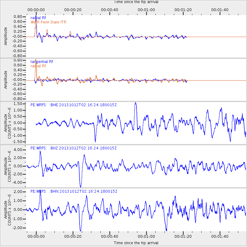
Signal To Noise
| Channel | StoN | STA | LTA |
| PE:WRPS: :BHZ:20131012T02:16:24.180015Z | 7.180719 | 1.5023658E-6 | 2.0922221E-7 |
| PE:WRPS: :BHN:20131012T02:16:24.180015Z | 4.45064 | 8.0013507E-7 | 1.7977976E-7 |
| PE:WRPS: :BHE:20131012T02:16:24.180015Z | 3.2753694 | 5.14929E-7 | 1.5721251E-7 |
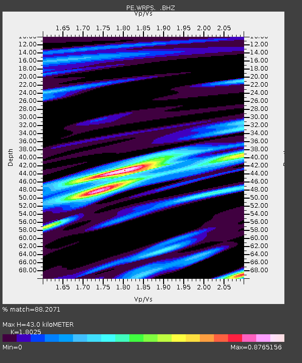
| Arrivals | |
| Ps | 6.0 SECOND |
| PpPs | 18 SECOND |
| PsPs/PpSs | 24 SECOND |

