You are here: Home > Network List > TA - USArray Transportable Network (new EarthScope stations) Stations List
> Station R60A Leonardtown, MD, USA > Earthquake Result Viewer
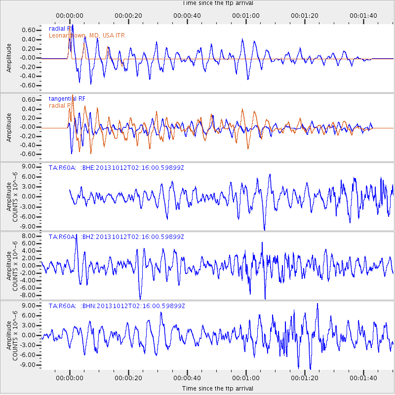
R60A Leonardtown, MD, USA - Earthquake Result Viewer
*The percent match for this event was below the threshold and hence no stack was calculated.
| Earthquake location: |
Near Coast Of Venezuela |
| Earthquake latitude/longitude: |
10.9/-62.3 |
| Earthquake time(UTC): |
2013/10/12 (285) 02:10:27 GMT |
| Earthquake Depth: |
63 km |
| Earthquake Magnitude: |
6.0 MWW, 6.0 MWW, 6.0 MWB, 6.0 MWC, 6.0 MI |
| Earthquake Catalog/Contributor: |
NEIC PDE/NEIC COMCAT |
|
| Network: |
TA USArray Transportable Network (new EarthScope stations) |
| Station: |
R60A Leonardtown, MD, USA |
| Lat/Lon: |
38.26 N/76.58 W |
| Elevation: |
33 m |
|
| Distance: |
30.1 deg |
| Az: |
337.239 deg |
| Baz: |
151.137 deg |
| Ray Param: |
$rayparam |
*The percent match for this event was below the threshold and hence was not used in the summary stack. |
|
| Radial Match: |
77.75106 % |
| Radial Bump: |
400 |
| Transverse Match: |
75.94147 % |
| Transverse Bump: |
400 |
| SOD ConfigId: |
626651 |
| Insert Time: |
2014-04-19 01:52:20.947 +0000 |
| GWidth: |
2.5 |
| Max Bumps: |
400 |
| Tol: |
0.001 |
|
Signal To Noise
| Channel | StoN | STA | LTA |
| TA:R60A: :BHZ:20131012T02:16:00.59899Z | 4.9614797 | 3.3225858E-6 | 6.696764E-7 |
| TA:R60A: :BHN:20131012T02:16:00.59899Z | 2.2662446 | 2.1731018E-6 | 9.588999E-7 |
| TA:R60A: :BHE:20131012T02:16:00.59899Z | 2.5539625 | 3.1030634E-6 | 1.2149997E-6 |
| Arrivals |
| Ps | |
| PpPs | |
| PsPs/PpSs | |


