You are here: Home > Network List > TA - USArray Transportable Network (new EarthScope stations) Stations List
> Station W50A Signal Mountain, TN, USA > Earthquake Result Viewer
W50A Signal Mountain, TN, USA - Earthquake Result Viewer

| Earthquake location: |
Near Coast Of Venezuela |
| Earthquake latitude/longitude: |
10.9/-62.3 |
| Earthquake time(UTC): |
2013/10/12 (285) 02:10:27 GMT |
| Earthquake Depth: |
63 km |
| Earthquake Magnitude: |
6.0 MWW, 6.0 MWW, 6.0 MWB, 6.0 MWC, 6.0 MI |
| Earthquake Catalog/Contributor: |
NEIC PDE/NEIC COMCAT |
|
| Network: |
TA USArray Transportable Network (new EarthScope stations) |
| Station: |
W50A Signal Mountain, TN, USA |
| Lat/Lon: |
35.20 N/85.31 W |
| Elevation: |
587 m |
|
| Distance: |
32.0 deg |
| Az: |
322.827 deg |
| Baz: |
133.56 deg |
| Ray Param: |
0.07870584 |
| Estimated Moho Depth: |
53.5 km |
| Estimated Crust Vp/Vs: |
1.71 |
| Assumed Crust Vp: |
6.35 km/s |
| Estimated Crust Vs: |
3.708 km/s |
| Estimated Crust Poisson's Ratio: |
0.24 |
|
| Radial Match: |
88.13222 % |
| Radial Bump: |
400 |
| Transverse Match: |
67.385315 % |
| Transverse Bump: |
400 |
| SOD ConfigId: |
626651 |
| Insert Time: |
2014-04-19 01:54:34.445 +0000 |
| GWidth: |
2.5 |
| Max Bumps: |
400 |
| Tol: |
0.001 |
|
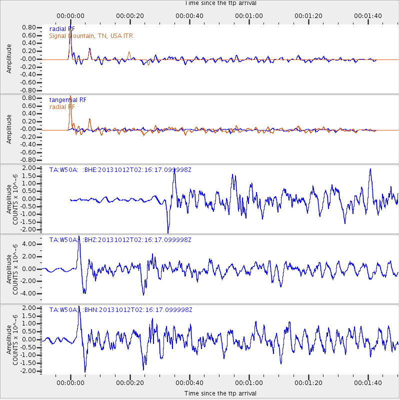
Signal To Noise
| Channel | StoN | STA | LTA |
| TA:W50A: :BHZ:20131012T02:16:17.099998Z | 15.109449 | 2.2379468E-6 | 1.481157E-7 |
| TA:W50A: :BHN:20131012T02:16:17.099998Z | 8.346796 | 8.582421E-7 | 1.02822945E-7 |
| TA:W50A: :BHE:20131012T02:16:17.099998Z | 11.36312 | 8.2554664E-7 | 7.265141E-8 |
| Arrivals |
| Ps | 6.5 SECOND |
| PpPs | 21 SECOND |
| PsPs/PpSs | 28 SECOND |


