You are here: Home > Network List > TA - USArray Transportable Network (new EarthScope stations) Stations List
> Station Z52A Williamson, GA, USA > Earthquake Result Viewer
Z52A Williamson, GA, USA - Earthquake Result Viewer

| Earthquake location: |
Near Coast Of Venezuela |
| Earthquake latitude/longitude: |
10.9/-62.3 |
| Earthquake time(UTC): |
2013/10/12 (285) 02:10:27 GMT |
| Earthquake Depth: |
63 km |
| Earthquake Magnitude: |
6.0 MWW, 6.0 MWW, 6.0 MWB, 6.0 MWC, 6.0 MI |
| Earthquake Catalog/Contributor: |
NEIC PDE/NEIC COMCAT |
|
| Network: |
TA USArray Transportable Network (new EarthScope stations) |
| Station: |
Z52A Williamson, GA, USA |
| Lat/Lon: |
33.19 N/84.42 W |
| Elevation: |
252 m |
|
| Distance: |
30.1 deg |
| Az: |
320.962 deg |
| Baz: |
132.462 deg |
| Ray Param: |
0.079340875 |
| Estimated Moho Depth: |
44.75 km |
| Estimated Crust Vp/Vs: |
1.94 |
| Assumed Crust Vp: |
6.719 km/s |
| Estimated Crust Vs: |
3.468 km/s |
| Estimated Crust Poisson's Ratio: |
0.32 |
|
| Radial Match: |
89.23675 % |
| Radial Bump: |
294 |
| Transverse Match: |
59.875885 % |
| Transverse Bump: |
400 |
| SOD ConfigId: |
626651 |
| Insert Time: |
2014-04-19 01:55:28.443 +0000 |
| GWidth: |
2.5 |
| Max Bumps: |
400 |
| Tol: |
0.001 |
|
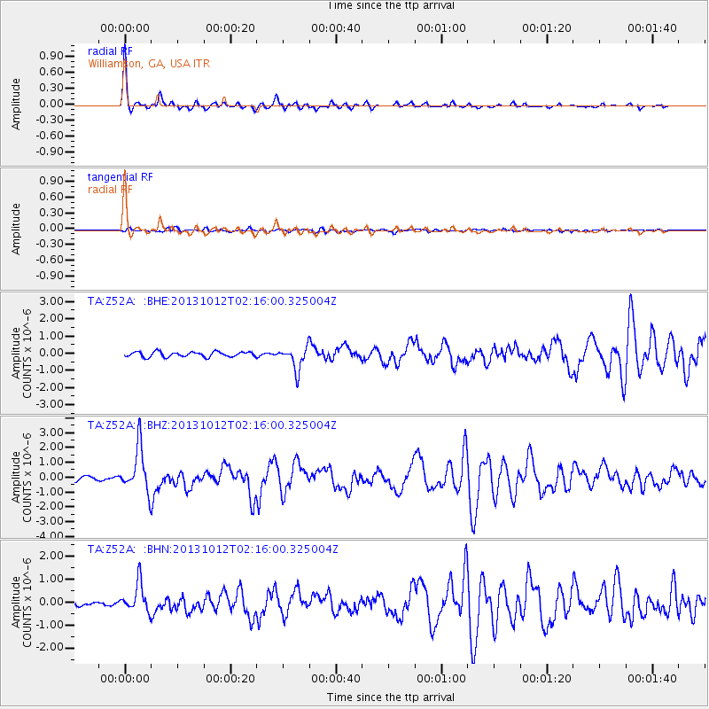
Signal To Noise
| Channel | StoN | STA | LTA |
| TA:Z52A: :BHZ:20131012T02:16:00.325004Z | 10.728078 | 1.5320419E-6 | 1.4280675E-7 |
| TA:Z52A: :BHN:20131012T02:16:00.325004Z | 6.018665 | 6.340841E-7 | 1.0535295E-7 |
| TA:Z52A: :BHE:20131012T02:16:00.325004Z | 4.685946 | 6.901749E-7 | 1.4728613E-7 |
| Arrivals |
| Ps | 6.8 SECOND |
| PpPs | 18 SECOND |
| PsPs/PpSs | 25 SECOND |


